Flag-map_of_Syria_(1946-1958,_1961-1963).svg

Size of this PNG preview of this SVG file:
707 × 600 pixels
.
Other resolutions:
283 × 240 pixels
|
566 × 480 pixels
|
905 × 768 pixels
|
1,207 × 1,024 pixels
|
2,414 × 2,048 pixels
|
1,042 × 884 pixels
.
Summary
| Description |
English:
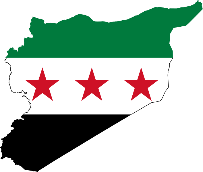
Map of Syria containing the flag of Syria used between 1932-1958 and 1961-1963, recently revived by some of the 2011-2012 protesters in Syria.
Note that these borders were not determined until ca. the early 1940s (after Alexandretta and Lebanon were detached from the French Mandate), so this is not a valid flag-map of Syria during the 1930s... |
| Date | |
| Source | Own work |
| Author | Дмитрий-5-Аверин |
| Other versions |
This
vector image
includes elements that have been taken or adapted from this file:
|
.svg)
Licensing
I, the copyright holder of this work, hereby publish it under the following license:
This file is licensed under the
Creative Commons
Attribution-Share Alike 3.0 Unported
license.
-
You are free:
- to share – to copy, distribute and transmit the work
- to remix – to adapt the work
-
Under the following conditions:
- attribution – You must give appropriate credit, provide a link to the license, and indicate if changes were made. You may do so in any reasonable manner, but not in any way that suggests the licensor endorses you or your use.
- share alike – If you remix, transform, or build upon the material, you must distribute your contributions under the same or compatible license as the original.