Flint_River_in_Flint_MIchigan.jpg
Size of this preview:
800 × 529 pixels
.
Other resolutions:
320 × 211 pixels
|
640 × 423 pixels
|
1,024 × 677 pixels
|
1,500 × 991 pixels
.
| Description |
English:
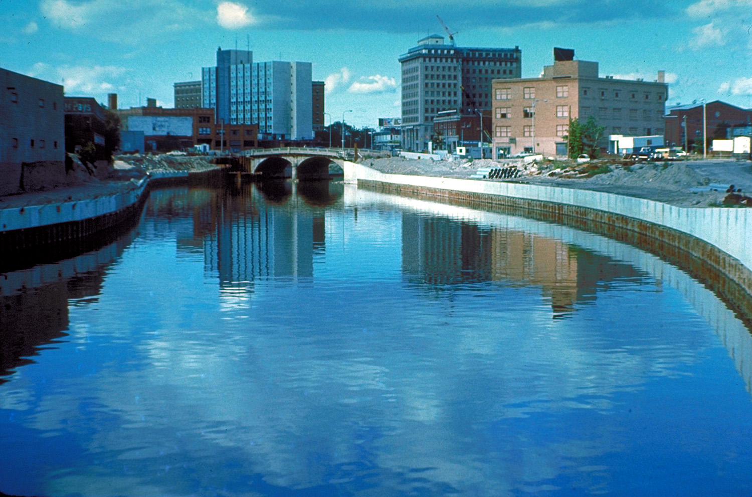
The Flint River in Flint, Michigan, USA, in the late 1970s during a U.S. Army Corps of Engineers flood control project, Taken from approximately halfway between the Grand Traverse Street bridge and Beach-Garland Street bridge, looking east. To the right in the distance is the former IMA Auditorium, later part of AutoWorld, demolished in 1997 to make way for an expansion of UM-Flint. The Northbank Center, to the right of the upper center of the photograph, is also now part of UM-Flint.
|
|||
| Date | circa 1979 | |||
| Source |
U.S. Army Corps of Engineers Digital Visual Library
Image page Image description page Digital Visual Library home page |
|||
| Author | U.S. Army Corps of Engineers, photographer not specified or unknown | |||
|
Permission
( Reusing this file ) |
|
|||
| Location | Flint, Michigan, USA |
| Camera location |
|
View this and other nearby images on: OpenStreetMap |
|
|---|