Floating_dock_Bermuda_at_HM_Dockyard_Bermuda.jpeg

Size of this preview:
800 × 463 pixels
.
Other resolutions:
320 × 185 pixels
|
640 × 371 pixels
|
1,024 × 593 pixels
|
1,280 × 741 pixels
|
2,560 × 1,483 pixels
|
6,416 × 3,716 pixels
.
| Description |
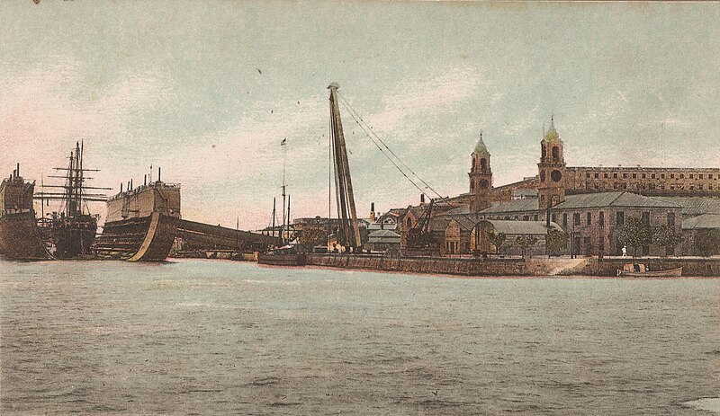
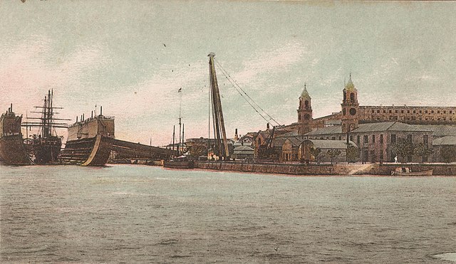
English:
The
Royal Navy
floating drydock
Bermuda
at the
Royal Naval Dockyard
on
Ireland Island
,
Bermuda
.
|
| Date | |
| Source | Contemporary card |
| Author | Royal Navy |
| Camera location |
|
View this and other nearby images on: OpenStreetMap |
|
|---|
|
|
This work
created by the United Kingdom Government
is in the
public domain
.
This is because it is one of the following :
HMSO has declared that the expiry of Crown Copyrights applies worldwide (ref:
HMSO Email Reply
)
|

|