Florida_Current_map.jpg
No higher resolution available.
Summary
| Description |
English:
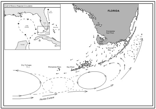
Map showing current patterns throughout the Florida Keys. Note how clockwise and counterclockwise gyres exist shoreward of the Florida Current.
|
| Date | |
| Source | http://oceanexplorer.noaa.gov/explorations/islands01/background/wind/media/fl_currents.html |
| Author | National Oceanic and Atmospheric Administration |

|
This
geology
image could be re-created
using
vector graphics
as an
SVG
file
. This has several advantages; see
Commons:Media for cleanup
for more information. If an SVG form of this image is available, please upload it and afterwards replace this template with
{{

vector version available

|

new image name

}}
.
It is recommended to name the SVG file “Florida Current map.svg”—then the template Vector version available (or Vva ) does not need the new image name parameter. |


Licensing
|
|
This image is in the
public domain
because it contains materials that originally came from the U.S.
National Oceanic and Atmospheric Administration
, taken or made as part of an employee's official duties.
|
|