Formative_Period_southern_Mesoamerica_2.svg

Size of this PNG preview of this SVG file:
800 × 380 pixels
.
Other resolutions:
320 × 152 pixels
|
640 × 304 pixels
|
1,024 × 486 pixels
|
1,280 × 608 pixels
|
2,560 × 1,215 pixels
|
1,241 × 589 pixels
.
Summary
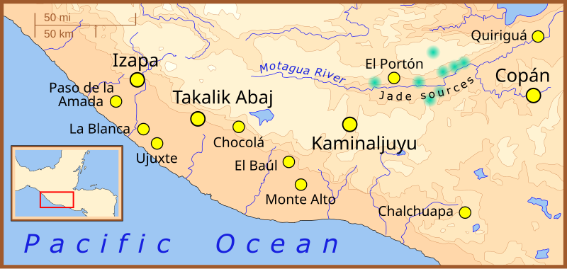
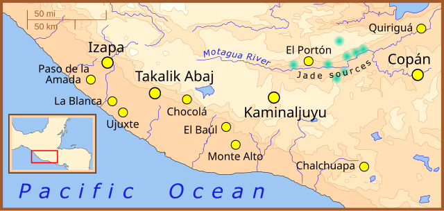
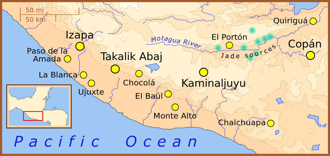
| Description | A map of the southern-most area of Mesoamerica , showing important Formative Period sites. |
| Date | |
| Source | Own work |
| Author | Madman2001 |
References
- Jadeite locations taken from: Lallemant, Hans G. Avé "Petrogenisis and Exhumation of Jadeitites in Guatemala" , Rice University, accessed February 2008.
- Elevations based on those in the Times Atlas of the World , 7th edition.
- Location of archaeological sites taken from map for the upcoming book: "The Southern Maya Area in the Late Preclassic: Urbanism, Rulership, and Ethnic Interaction.", in press at the University Press of Colorado, Boulder, Michael Love and Jonathan Kaplan, eds.
Licensing
I, the copyright holder of this work, hereby publish it under the following license:
This file is licensed under the
Creative Commons
Attribution-Share Alike 3.0 Unported
license.
-
You are free:
- to share – to copy, distribute and transmit the work
- to remix – to adapt the work
-
Under the following conditions:
- attribution – You must give appropriate credit, provide a link to the license, and indicate if changes were made. You may do so in any reasonable manner, but not in any way that suggests the licensor endorses you or your use.
- share alike – If you remix, transform, or build upon the material, you must distribute your contributions under the same or compatible license as the original.