FortRoss-chapel-reconstructed.jpg
Size of this preview:
800 × 533 pixels
.
Other resolutions:
320 × 213 pixels
|
640 × 426 pixels
|
1,024 × 682 pixels
|
1,280 × 853 pixels
|
2,032 × 1,354 pixels
.
|
|
This is an image of a place or building that is listed on the
National Register of Historic Places
in the
United States of America
. Its reference number is
66000239
.
|
| Camera location |
|
View this and other nearby images on: OpenStreetMap |
|
|---|
Summary
| Description |
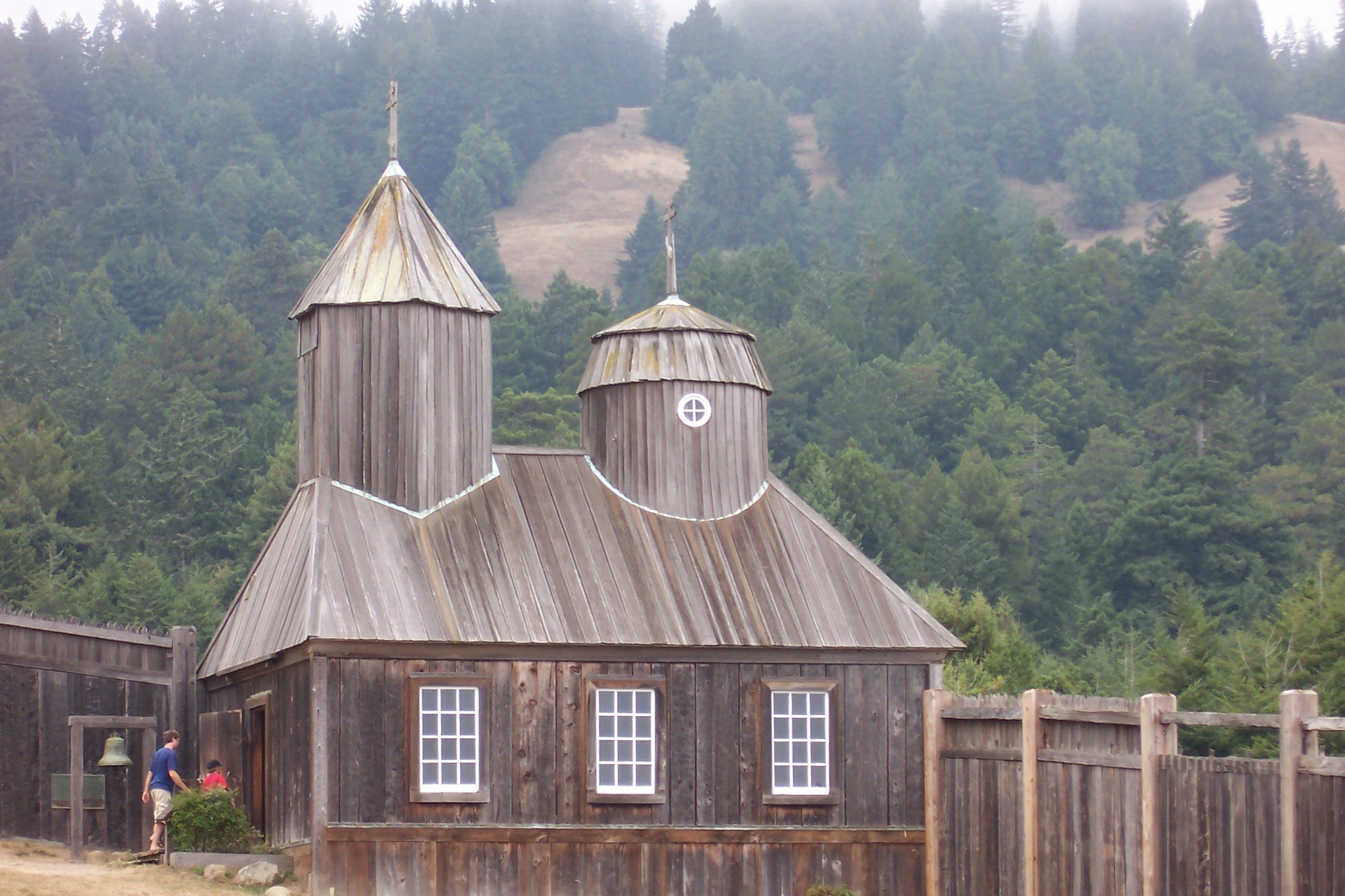
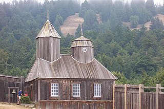
The chapel in Fort Ross (reconstructed), California , USA. Fort Ross is the US National Historic Landmark of history of Russian colonization of America.
Français :
La chapelle reconstruite de Fort Ross
Русский:
Церковь в Форт Росс
|
| Date | photo taken Aug 2005 |
| Source | Own work |
| Author | User:Introvert |
|
Permission
( Reusing this file ) |
User:Introvert put under the cc-by-sa. |
Licensing
I, the copyright holder of this work, hereby publish it under the following license:
This file is licensed under the
Creative Commons
Attribution-Share Alike 2.5 Generic
license.
-
You are free:
- to share – to copy, distribute and transmit the work
- to remix – to adapt the work
-
Under the following conditions:
- attribution – You must give appropriate credit, provide a link to the license, and indicate if changes were made. You may do so in any reasonable manner, but not in any way that suggests the licensor endorses you or your use.
- share alike – If you remix, transform, or build upon the material, you must distribute your contributions under the same or compatible license as the original.