Fossil_Footprints_Arthropleura_-_geograph.org.uk_-_1994274.jpg
Size of this preview:
450 × 600 pixels
.
Other resolutions:
180 × 240 pixels
|
600 × 800 pixels
.
Summary
| Description |
English:
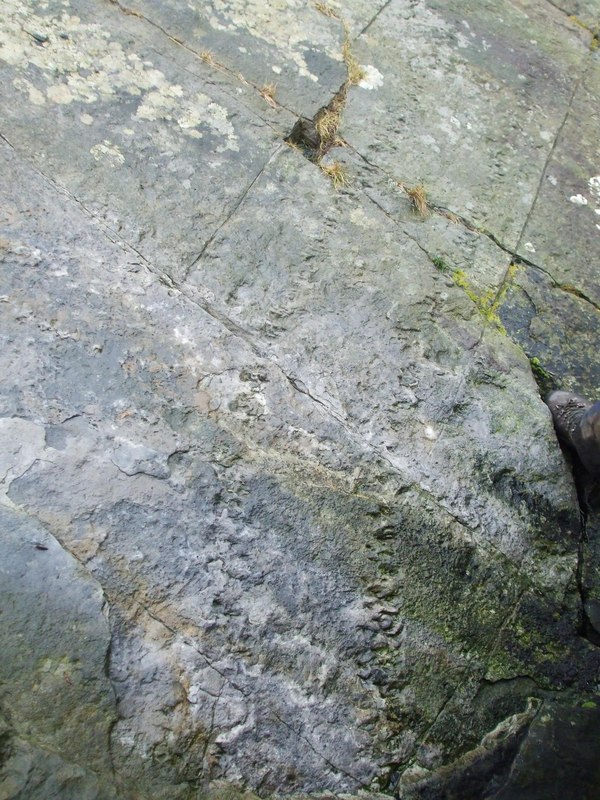
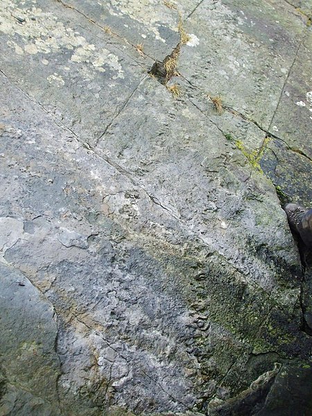
Fossil trackway of a large Myriapod, presumably
Arthropleura
, on the bedding plane of a Namurian (early Late Carboniferous) sandstone, NE coast of Isle of Arran, 4 km from Lochranza, North Ayrshire, Great Britain. This trail is the type specimen of the ichnospecies
Diplichnites cuithensis
.
[1]
.
|
| Date | |
| Source | From geograph.org.uk ; transferred by User:Rubberstamp using geograph_org2commons . |
| Author | Ashley Dace |
|
Permission
( Reusing this file ) |
Creative Commons Attribution Share-alike license 2.0 |
| Camera location |
|
View this and other nearby images on: OpenStreetMap |
|
|---|
| Object location |
|
View this and other nearby images on: OpenStreetMap |
|
|---|
_region:GB-GBN_heading:337.00&language=en)
Licensing

|
This image was taken from the
Geograph project
collection. See
this photograph's page
on the Geograph website for the photographer's contact details. The copyright on this image is owned by
Ashley Dace
and is licensed for reuse under the
Creative Commons
Attribution-ShareAlike 2.0 license.
|
This file is licensed under the
Creative Commons
Attribution-Share Alike 2.0 Generic
license.
Attribution:
Ashley Dace
-
You are free:
- to share – to copy, distribute and transmit the work
- to remix – to adapt the work
-
Under the following conditions:
- attribution – You must give appropriate credit, provide a link to the license, and indicate if changes were made. You may do so in any reasonable manner, but not in any way that suggests the licensor endorses you or your use.
- share alike – If you remix, transform, or build upon the material, you must distribute your contributions under the same or compatible license as the original.