Four_Corners_Monument_Marker_2012.jpg

Size of this preview:
600 × 600 pixels
.
Other resolutions:
240 × 240 pixels
|
480 × 480 pixels
|
640 × 640 pixels
.
Summary
| Description |
English:
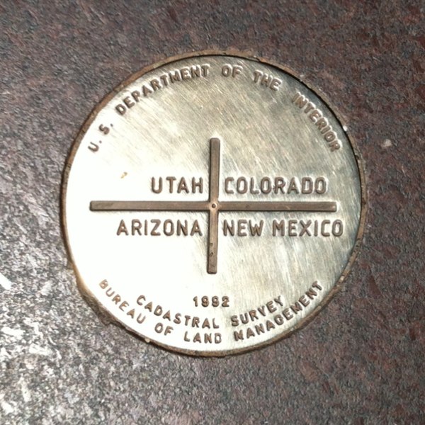
Metallic plate marking the "
four corners
" spot where the boundaries of the U.S. states of Colorado, New Mexico, Arizona, and Utah meet.
|
| Date | |
| Source | Own work : Photograph made by me |
| Author | Struhs |
| Object location |
|
View this and other nearby images on: OpenStreetMap |
|
|---|
Licensing
|
|
This file is made available under the Creative Commons CC0 1.0 Universal Public Domain Dedication . |
|
The person who associated a work with this deed has dedicated the work to the
public domain
by waiving all of their rights to the work worldwide under copyright law, including all related and neighboring rights, to the extent allowed by law. You can copy, modify, distribute and perform the work, even for commercial purposes, all without asking permission.
|
Original upload log
Transferred from en.wikipedia to Commons using For the Common Good .
The original description page was
here
. All following user names refer to en.wikipedia.
| Date/Time | Dimensions | User | Comment |
|---|---|---|---|
| 23:14, 27 June 2012 | 640 × 640 (300,338 bytes) | w:en:Struhs ( talk | contribs ) | (Uploading a self-made file using [[Wikipedia:File_Upload_Wizard|File Upload Wizard]]) |