Fourpeaked-map1.jpg

Size of this preview:
684 × 599 pixels
.
Other resolutions:
274 × 240 pixels
|
548 × 480 pixels
.
Summary
| Description |
English:
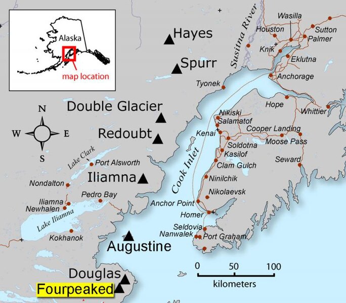
AVO map shows the location of Fourpeaked volcano
|
| Source | Map created by Seth Snedigar and Janet Schaafer for the United States Geological Survey's Alaska Volcano Observatory and the Alaska Division of Geological & Geophysical Surveys |
| Author | Seth Snedigar and Janet Schaafer for the United States Geological Survey's Alaska Volcano Observatory and the Alaska Division of Geological & Geophysical Surveys |
Licensing
|
|
This image is in the
public domain
in the United States because it only contains materials that originally came from the
United States Geological Survey
, an agency of the
United States Department of the Interior
. For more information, see
the official USGS copyright policy
.
|
|
Original upload log
Transferred from en.wikipedia to Commons by Magnus Manske using CommonsHelper .
The original description page was
here
. All following user names refer to en.wikipedia.
- 2006-09-23 04:05 Michaelh2001 280×246× (18956 bytes) {{PD-USGov}}