Frankfurt_Am_Main-Altstadt-Zerstoerung-Luftbild_1944.jpg

Size of this preview:
745 × 599 pixels
.
Other resolutions:
299 × 240 pixels
|
597 × 480 pixels
|
955 × 768 pixels
|
1,273 × 1,024 pixels
|
2,546 × 2,048 pixels
|
6,971 × 5,607 pixels
.
Summary
| Description |
English:
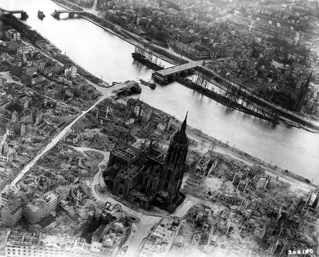
Frankfurt on the Main: Center of the Altstadt (Old Town) with the Cathedral, western part of the Fischerfeldviertel (Fisher Field Quarter) and the major part of Sachsenhausen with heavy damage and devastations of the allied bombings of World War II as seen from the air from about the
Braubachstrasse
(Braubach Street) to the south
Deutsch:
Frankfurt am Main: Zentrum der Altstadt mit dem Dom, westlicher Teil des Fischerfeldviertels und der größte Teil von Sachsenhausen mit erheblichen Zerstörungen und Schäden der allierten Bombardements des Zweiten Weltkrieges, ungefähr von Höhe der
Braubachstraße
aus der Luft nach Süden gesehen
Français :
Francfort sur le Main: Centre de la Vieille Ville avec vue sur la cathédrale, la partie Ouest du quartier Fischerfeld et de la majeure partie de Sachsenhausen. Les lourds dégats et destructions suite aux bombardements alliés de la Seconde Guerre Mondiale sont visibles sur cette vue aérienne de la rue Braubach vers le Sud.
|
| Date | Taken on 31 March 1945 |
| Source | Private collection Mylius |
| Author | Unknown author |
| Camera location |
|
View this and other nearby images on: OpenStreetMap |
|
|---|
Licensing
|
|
This image or file is a work of a
U.S. Air Force
Airman or employee, taken or made as part of that person's official duties. As a
work
of the
U.S. federal government
, the image or file is in the
public domain
in the United States.
|

|