Fukushima_radiation_dose_map_2011-04-29.png
Size of this preview:
424 × 599 pixels
.
Other resolutions:
170 × 240 pixels
|
573 × 810 pixels
.
Summary
| Description |
English:
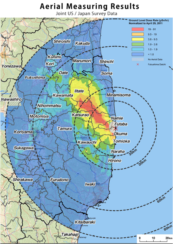
A map of the instant radioactivity of the Fukushima reactor area, as measured from the air.
|
| Date | |
| Source | https://origins.osu.edu/article/46/maps |
| Author | United States Department of Energy |
Licensing
|
|
This image is a work of a
United States Department of Energy
(or predecessor organization) employee, taken or made as part of that person's official duties. As a
work
of the
U.S. federal government
, the image is in the
public domain
.
Please note that national laboratories operate under varying licences and some are not free . Check the site policies of any national lab before crediting it with this tag.
|

|