GA_National_Forest.png

Size of this preview:
800 × 458 pixels
.
Other resolutions:
320 × 183 pixels
|
640 × 367 pixels
|
1,024 × 587 pixels
|
1,280 × 733 pixels
|
3,027 × 1,734 pixels
.
Summary
| Description | |
| Source | Transferred from en.wikipedia by Ronhjones |
| Author |
Licensing
|
|
This image is in the
public domain
in the United States because it only contains materials that originally came from the
United States Geological Survey
, an agency of the
United States Department of the Interior
. For more information, see
the official USGS copyright policy
.
|
|
Original upload log
The original description page was
here
. All following user names refer to en.wikipedia.
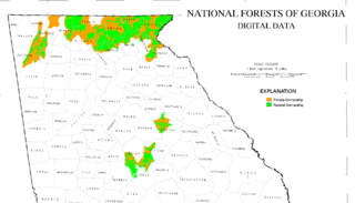
Upload date | User | Bytes | Dimensions | Comment
- 2006-10-27 01:24 (UTC) | Tlmclain | 208415 (bytes) | 3027×1734 | Map of National Forest land in [[Georgia]]. Source: [http://csat.er.usgs.gov/statewide/layers/forest.html USGS] {{PD-USGov-Interior-USGS}}