Gafilo_2004-03-03.jpg

Size of this preview:
600 × 600 pixels
.
Other resolutions:
240 × 240 pixels
|
480 × 480 pixels
|
768 × 768 pixels
|
1,024 × 1,024 pixels
|
2,048 × 2,048 pixels
|
6,000 × 6,000 pixels
.
Summary
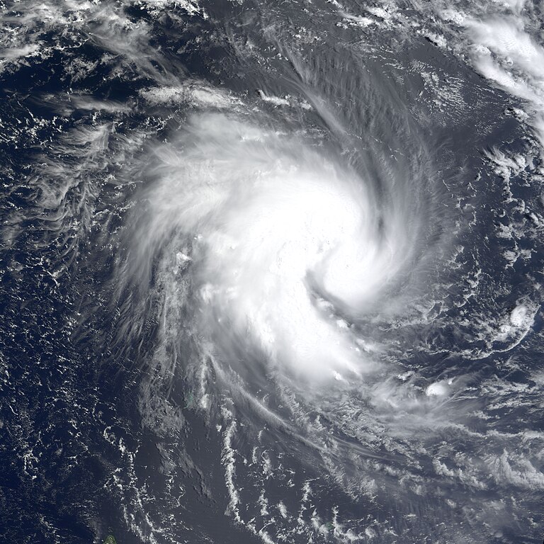
| Description | The MODIS instrument onboard NASA's Terra satellite captured this true-color image of Tropical Cyclone Gafilo as it was churning in the Indian Ocean approximately 800 miles northwest of northern Madagascar. At the time this image was acquired, Gafilo had maximum sustained winds near 75 mph and was moving west at 8 mph. Gafilo was expected to strengthen and take a turn towards the southwest and possibly affect northern Madagascar by the weekend. | |||||
| Date | ||||||
| Source | http://earthobservatory.nasa.gov/NaturalHazards/natural_hazards_v2.php3?img_id=11984 | |||||
| Author | Image courtesy Jesse Allen, NASA Earth Observatory at NASA GSFC. | |||||
|
Permission
( Reusing this file ) |
|
