Garibaldi_Lake_area_map.jpg
No higher resolution available.
Summary
| Description |
English:
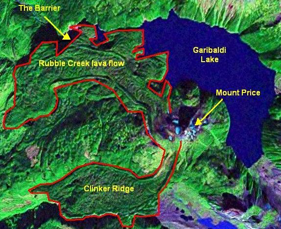
Map of volcanic features around Garibaldi Lake.
|
| Date | |
| Source | NASA World Wind |
| Author | NASA/ Black Tusk |
|
Permission
( Reusing this file ) |
NASA, public domian |
Licensing
|
|
This image is in the
public domain
because it is a screenshot from
NASA
’s globe software
World Wind
using a public domain layer, such as Blue Marble, MODIS, Landsat, SRTM, USGS or GLOBE.
|

|