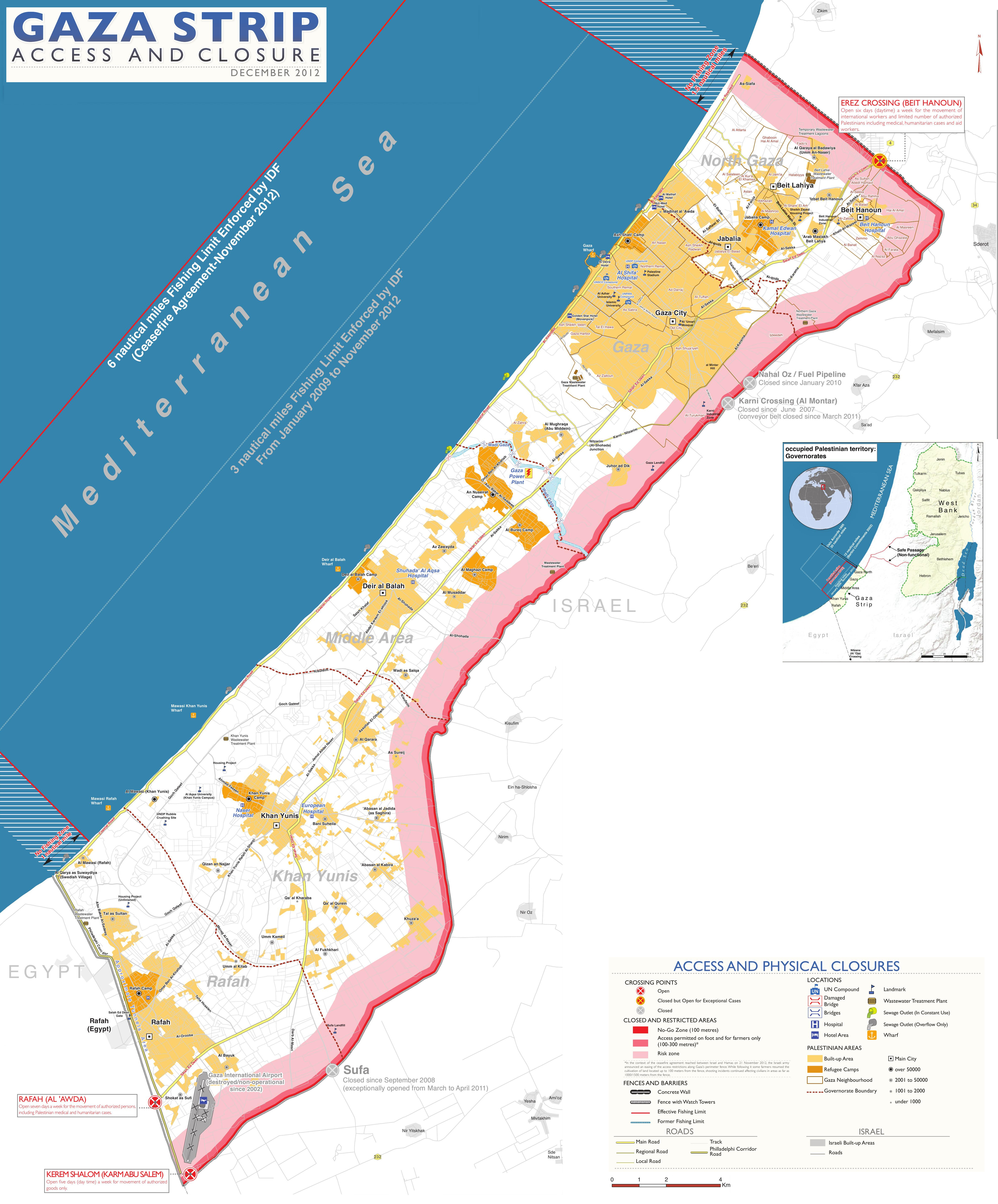
Gaza_closure_December_2012.jpg
Size of this preview:
497 × 600 pixels
.
Other resolutions:
199 × 240 pixels
|
398 × 480 pixels
|
636 × 768 pixels
|
848 × 1,024 pixels
|
1,697 × 2,048 pixels
|
4,732 × 5,712 pixels
.
Summary
| Description |
English:
Gaza Strip with Israeli-controlled borders and limited fishing zone, as of December 2012. Based on Closure Map:
Gaza Strip Access and Closure
, published by
United Nations Office for the Coordination of Humanitarian Affairs
(OCHAoPt), 22 February 2013
العربية:
حدود قطاع غزة تسيطر عليها إسرائيل ومنطقة صيد محدودة ، اعتبارًا من ديسمبر 2012. استنادًا إلى خريطة الإغلاق: الوصول إلى قطاع غزة وإغلاقه ، نشرها مكتب الأمم المتحدة لتنسيق الشؤون الإنسانية (أوتشاوبت) ، 22 فبراير 2013
|
| Date | |
| Source | Own work , based on http://www.ochaopt.org/documents/ocha_opt_gaza_access_and_closure_map_december_2012.pdf (dead link) |
| Author | Wickey-nl |
| Other versions |
|

Licensing
I, the copyright holder of this work, hereby publish it under the following license:
This file is licensed under the
Creative Commons
Attribution 3.0 Unported
license.
-
You are free:
- to share – to copy, distribute and transmit the work
- to remix – to adapt the work
-
Under the following conditions:
- attribution – You must give appropriate credit, provide a link to the license, and indicate if changes were made. You may do so in any reasonable manner, but not in any way that suggests the licensor endorses you or your use.
