Geikie_Plateau_Glacier.JPG

Size of this preview:
800 × 600 pixels
.
Other resolutions:
320 × 240 pixels
|
640 × 480 pixels
|
1,024 × 768 pixels
.
Summary
| Description |
English:
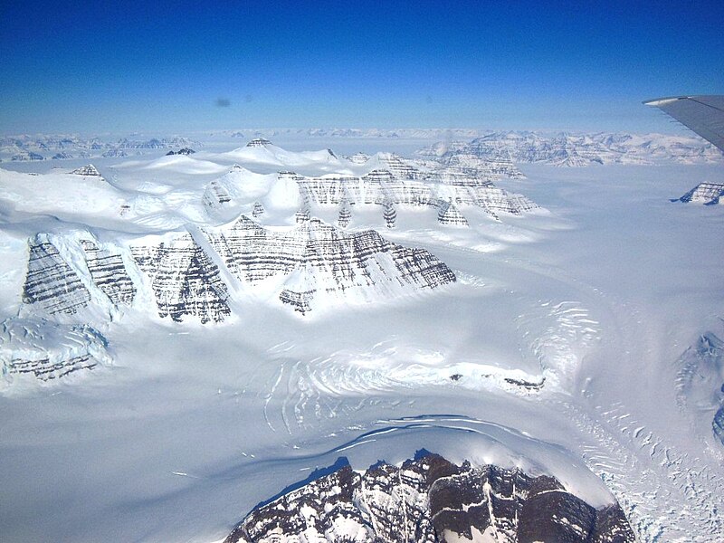
Geikie Plateau glacier and mountain peaks in eastern Greenland seen from NASA's P-3B during an IceBridge survey flight on Apr. 11, 2013. The distinctive layering in the Geikie Plateau's mountains come from repeated flooding of basalt lava from the North Atlantic's mid-ocean ridge millions of years ago.
|
| Date | |
| Source | http://www.nasa.gov/mission_pages/icebridge/multimedia/spr13/DSCN3043.html |
| Author | NASA / Christy Hansen |
Licensing
|
|
This file is in the public domain in the United States because it was solely created by NASA . NASA copyright policy states that "NASA material is not protected by copyright unless noted ". (See Template:PD-USGov , NASA copyright policy page or JPL Image Use Policy .) |
|

|
Warnings:
|