General_Government_for_the_occupied_Polish_territories_(1941).png

Size of this preview:
605 × 600 pixels
.
Other resolutions:
242 × 240 pixels
|
484 × 480 pixels
|
774 × 768 pixels
|
1,033 × 1,024 pixels
|
2,299 × 2,280 pixels
.
Summary
| Description |
English:
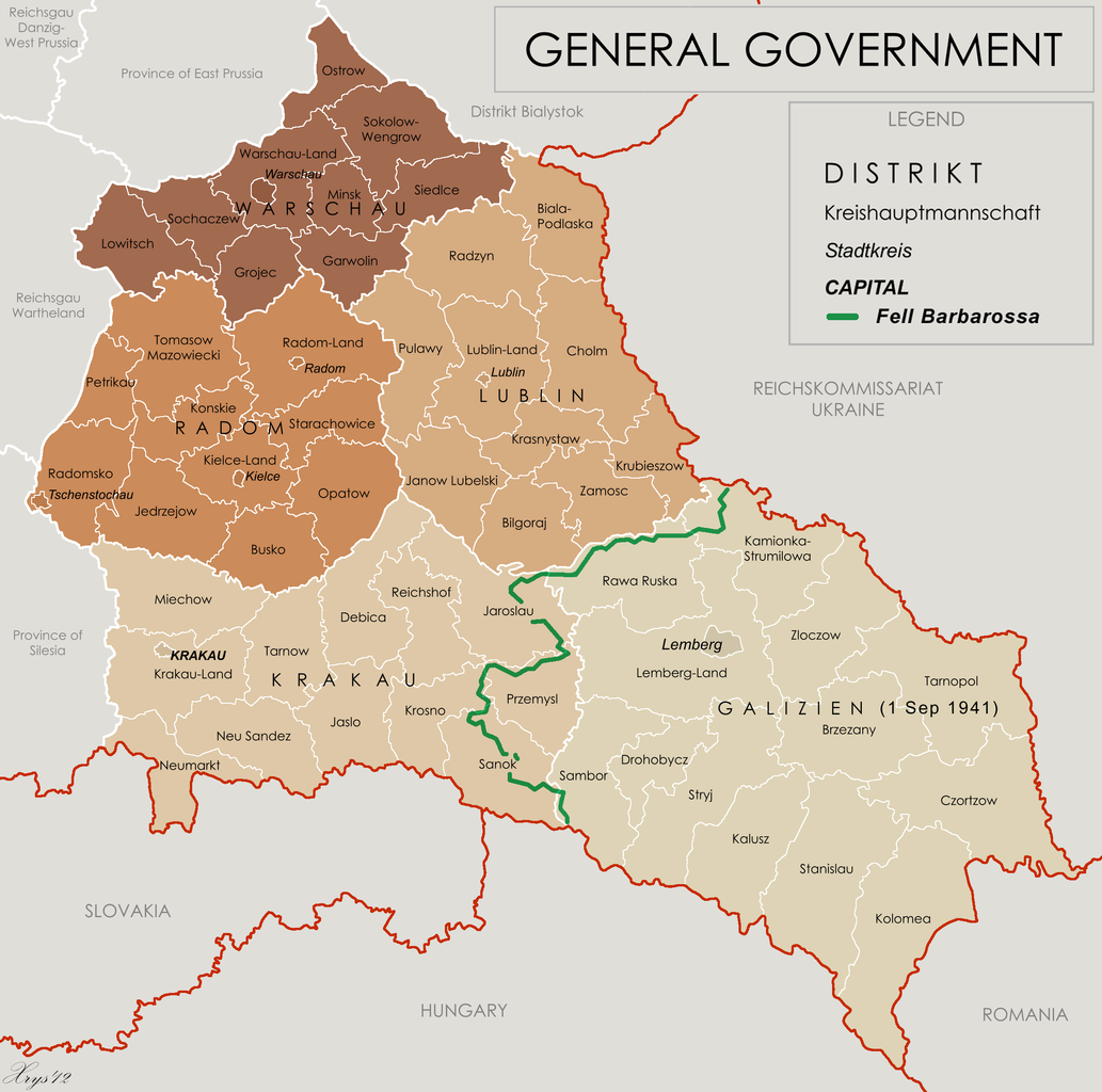
Map of the administrative areas of the General Government
|
| Date | |
| Source |
Own work by XrysD , edited by Poeticbent with superimposed German-Soviet border before Operation Barbarossa. Sources at: File:Generalne gubernatorstwo 1945.png and File:Western portions of the Ukrainian SSR 1940.jpg A published source with the same information is Musial, Bogdan (2000) (in German) Deutsche Zivilverwaltung und Judenverfolgung im Generalgouvernement: eine Fallstudie zum Distrikt Lublin 1939-1944 , Otto Harrassowitz Verlag, p. 424 ISBN : 978-3-447-05063-0 . |
| Author | XrysD and User:Poeticbent (the 1941 demarkation line and legend) |
| Other versions |
File:Generalgouvernement fur die besetzten polnischen gebiete.png

|
Licensing
This file is licensed under the
Creative Commons
Attribution-Share Alike 3.0 Unported
license.
-
You are free:
- to share – to copy, distribute and transmit the work
- to remix – to adapt the work
-
Under the following conditions:
- attribution – You must give appropriate credit, provide a link to the license, and indicate if changes were made. You may do so in any reasonable manner, but not in any way that suggests the licensor endorses you or your use.
- share alike – If you remix, transform, or build upon the material, you must distribute your contributions under the same or compatible license as the original.