Geo_Map_of_Median_Income_by_Location_in_Maryland.png
Size of this preview:
800 × 584 pixels
.
Other resolutions:
320 × 234 pixels
|
640 × 467 pixels
|
1,024 × 748 pixels
|
1,208 × 882 pixels
.
Summary
| Description |
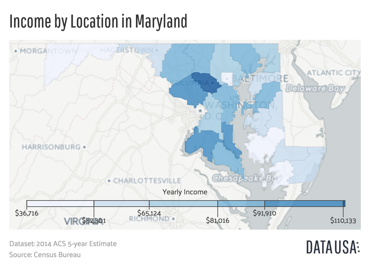
English:
A map showing Maryland's median income by county. Data is sourced from the
2014 ACS 5-year Estimate
report published by the
US Census Bureau
.
|
||
| Date | |||
| Source | http://datausa.io/profile/geo/maryland/#income_geo | ||
| Author | Datawheel, LLC | ||
| Other versions |
|

Licensing

|
This work is
free software
; you can redistribute it and/or modify it under the terms of the
GNU Affero General Public License
as published by the
Free Software Foundation
; either version 3 of the License, or any later version. This work is distributed in the hope that it will be useful, but without any warranty; without even the implied warranty of merchantability or fitness for a particular purpose. See
version 3 of the GNU Affero General Public License
for more details.
|