Geologic_Map_of_Georgia.png
Size of this preview:
528 × 600 pixels
.
Other resolutions:
211 × 240 pixels
|
422 × 480 pixels
|
676 × 768 pixels
|
901 × 1,024 pixels
|
1,802 × 2,048 pixels
|
2,640 × 3,000 pixels
.
| Description | |
| Source | |
| Author |
Licensing
|
|
This image is in the
public domain
in the United States because it only contains materials that originally came from the
United States Geological Survey
, an agency of the
United States Department of the Interior
. For more information, see
the official USGS copyright policy
.
|
|
Original upload log
The original description page was
here
. All following user names refer to en.wikipedia.
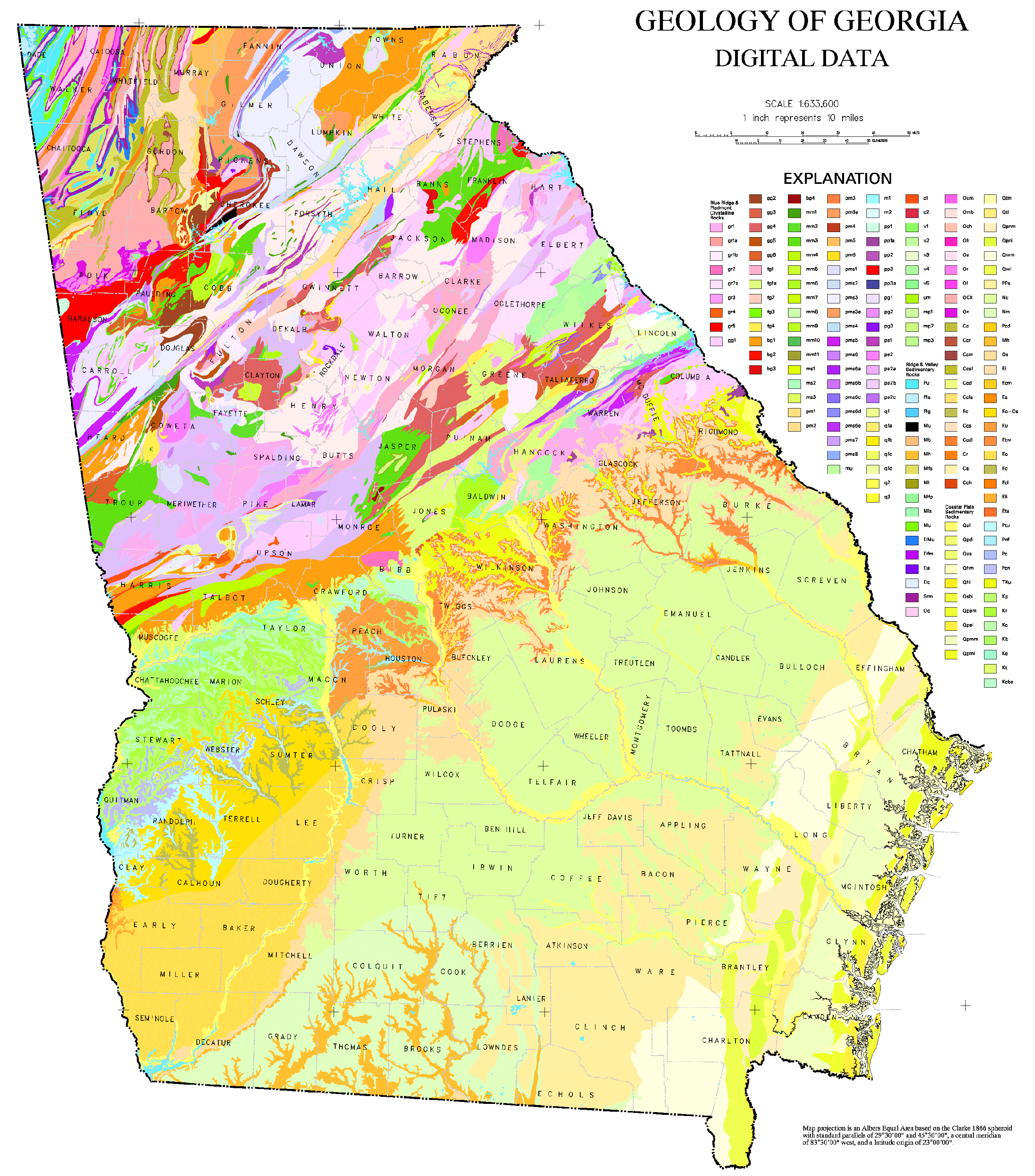
- 2006-10-24 21:50 Tlmclain 3086×3450× (1836224 bytes) The map compilation was published by the Georgia Geologic Survey in 1976 as the Geologic Map of [[Georgia (U.S. State)|Georgia]]. Source: [http://csat.er.usgs.gov/statewide/layers/geology.html USGS] {{PD-USGov-Interior-USGS}} [[Category:Georgia (U.S. sta