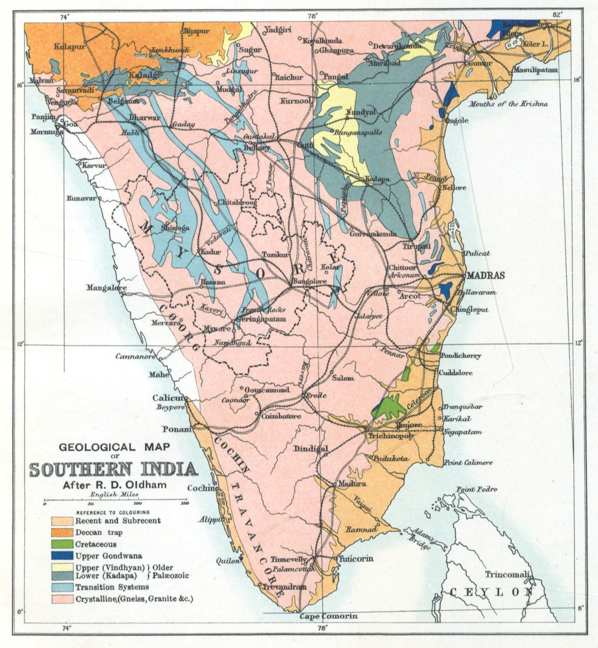
Geology_Gazetteer_map_1897.jpg
Summary
| Title |
Geological map of Southern India
|
|||||||||
| Date | ||||||||||
| Source |
Image extracted from page 91 of volume 01 of Mysore: a gazetteer compiled for Government. Revised edition , by Rice, B. Lewis (Benjamin Lewis). Original held and digitised by the British Library. Copied from Flickr . Note: The colours, contrast and appearance of these illustrations are unlikely to be true to life. They are derived from scanned images that have been enhanced for machine interpretation and have been altered from their originals.
|
|||||||||
| Creator |
Governmentof Mysore
|
|||||||||
|
Permission
( Reusing this file ) |
|
|||||||||
| Geotemporal data | ||||||||||
| Bounding box |
|
|||||||||
| Georeferencing | ||||||||||
| Archival data | ||||||||||
| Accession number |
British Library HMNTS 010056.g.12.
|
|||||||||
