Ghana_rel_2007.jpg
Size of this preview:
496 × 599 pixels
.
Other resolutions:
199 × 240 pixels
|
397 × 480 pixels
|
636 × 768 pixels
|
1,047 × 1,265 pixels
.
Summary
| Description |
English:
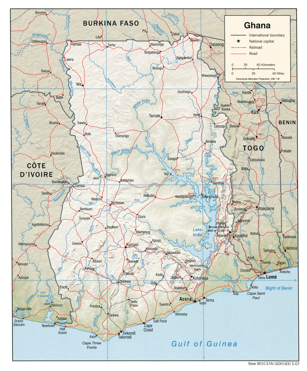
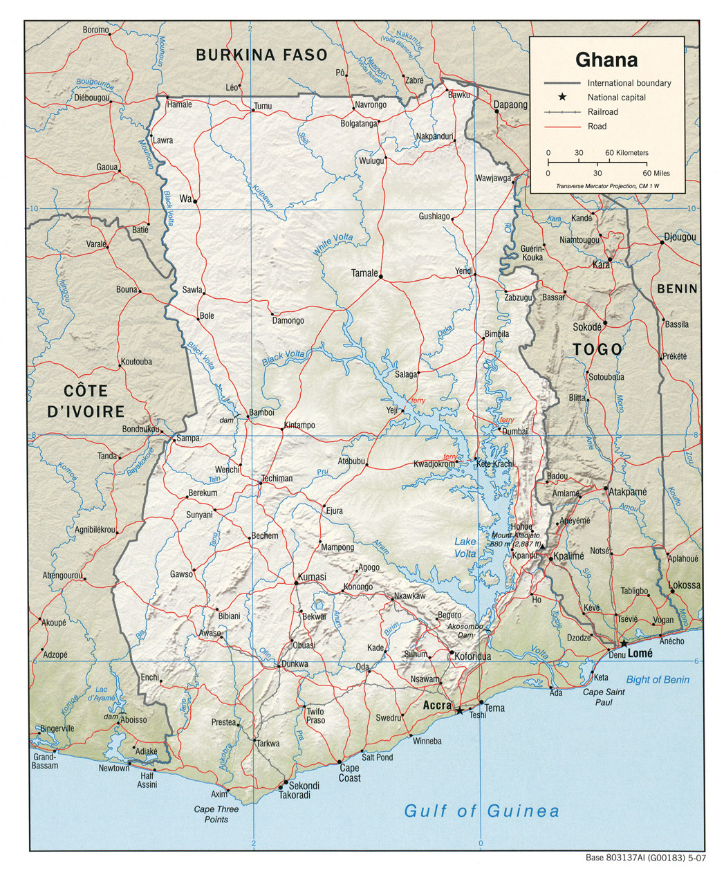
CIA shaded relief map of Ghana, 2007.
|
| Date | |
| Source | University of Texas Libraries, Perry-Castañeda Library Map Collection: Ghana Maps |
| Author | United States Central Intelligence Agency |
Licensing
|
|
This image is in the
public domain
because it contains materials that originally came from the United States
Central Intelligence Agency
's
World Factbook
.
|

|