Gibraltar_and_Bay_map_1750.jpg

Summary
| Description |
English:
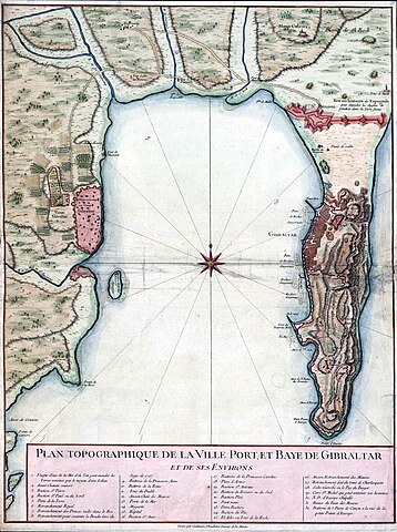
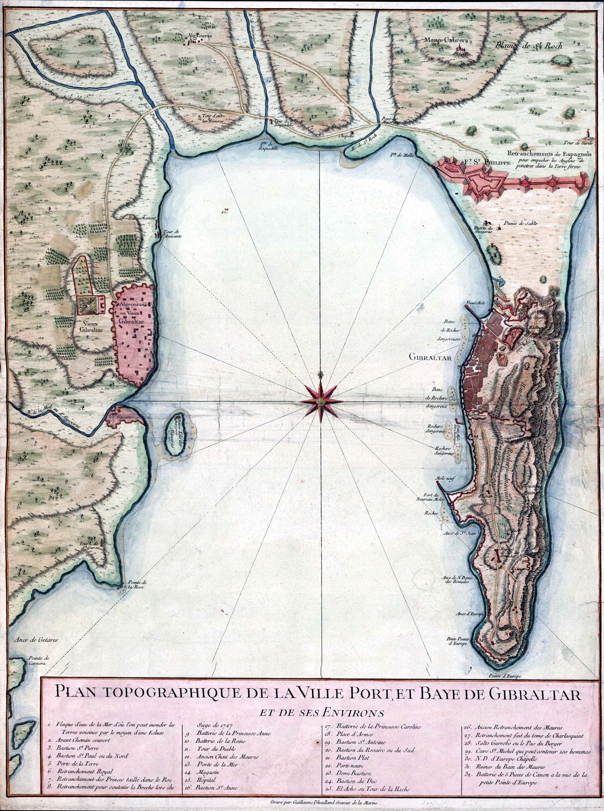
Topographic map of Gibraltar and the Bay of Gibraltar, circa 1750
Français :
Plan Topographique De La Ville Port, Et Baye De Gibraltar, Et De Ses Environs.
Español:
Plano de la Bahía de Algeciras datado en 1750. Se observan las ciudades de Algeciras y Gibraltar así como la Línea de Contravalación, fortificación construida en el istmo durante la década de 1730.
|
| Date | circa 1750 |
| Source | http://www.britishempire.co.uk/images3/gibraltar1750.jpg |
| Author | Guillaume Dheulland (1700–1770) |
Licensing
|
This is a faithful photographic reproduction of a two-dimensional,
public domain
work of art. The work of art itself is in the public domain for the following reason:
The official position taken by the Wikimedia Foundation is that "
faithful reproductions of two-dimensional public domain works of art are public domain
".
This photographic reproduction is therefore also considered to be in the public domain in the United States. In other jurisdictions, re-use of this content may be restricted; see Reuse of PD-Art photographs for details.
{{PD-Art}}
template without license parameter: please specify why the underlying work is public domain in both the source country and the United States
( Usage: {{PD-Art|1=|deathyear=''year of author's death''|country=''source country''}} , where parameter #1 can be PD-old-auto , PD-old-auto-expired , PD-old-auto-1996 , PD-old-100 or similar. See Commons:Multi-license copyright tags for more information. ) |
||||