Glacier_at_summit_of_Mt_Kilimanjaro_001.JPG

Size of this preview:
800 × 599 pixels
.
Other resolutions:
320 × 239 pixels
|
640 × 479 pixels
.
| Description |
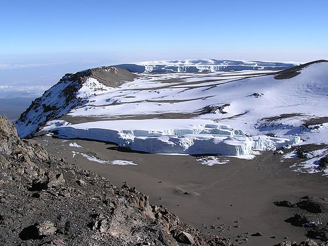
English:
Glacier at summit of Mt
Kilimanjaro
. This is the
Furtwängler Glacier
which has been rapidly disappearing, having lost a third of its thickness between 2000 and 2006.
Deutsch:
Blick vom Uhuru Peak (Gipfel des Kibo) über den Rest des Furtwängler-Gletschers zum Nordeisfeld, die größte zusammenhängende Eisfläche am Kibo.
|
| Date | |
| Source | Photo by Yosemite . |
| Author | Yosemite . |
| Camera location |
|
View this and other nearby images on: OpenStreetMap |
|
|---|

|
Permission is granted to copy, distribute and/or modify this document under the terms of the GNU Free Documentation License , Version 1.2 or any later version published by the Free Software Foundation ; with no Invariant Sections, no Front-Cover Texts, and no Back-Cover Texts. A copy of the license is included in the section entitled GNU Free Documentation License . |
|
|
This file is licensed under the Creative Commons Attribution-Share Alike 3.0 Unported license. | |
|
||
| This licensing tag was added to this file as part of the GFDL licensing update . |