GovernatoratoDalmazia.jpg
Size of this preview:
796 × 599 pixels
.
Other resolutions:
319 × 240 pixels
|
638 × 480 pixels
|
846 × 637 pixels
.
Summary
| Description |
English:
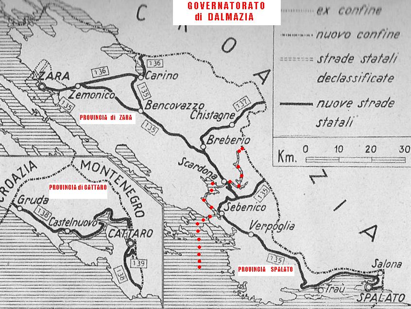
Map of "Governatorato di Dalmazia" (1941-1943) taken from old book about Italian history during WWII, edited in 1941. I have cut the image and added data in red with my software.
Español:
Mapa del
Governatorato di Dalmazia
(
Gobernación de Dalmacia
) entre 1941 y 1943.
|
| Date | |
| Source | Own work |
| Author | Firstpangea |
Licensing
I, the copyright holder of this work, hereby publish it under the following license:
This file is licensed under the
Creative Commons
Attribution-Share Alike 3.0 Unported
license.
-
You are free:
- to share – to copy, distribute and transmit the work
- to remix – to adapt the work
-
Under the following conditions:
- attribution – You must give appropriate credit, provide a link to the license, and indicate if changes were made. You may do so in any reasonable manner, but not in any way that suggests the licensor endorses you or your use.
- share alike – If you remix, transform, or build upon the material, you must distribute your contributions under the same or compatible license as the original.