Grand_cayman.jpg

Size of this preview:
603 × 599 pixels
.
Other resolutions:
242 × 240 pixels
|
483 × 480 pixels
|
773 × 768 pixels
|
1,031 × 1,024 pixels
|
2,061 × 2,048 pixels
|
5,059 × 5,026 pixels
.
| Description |
English:
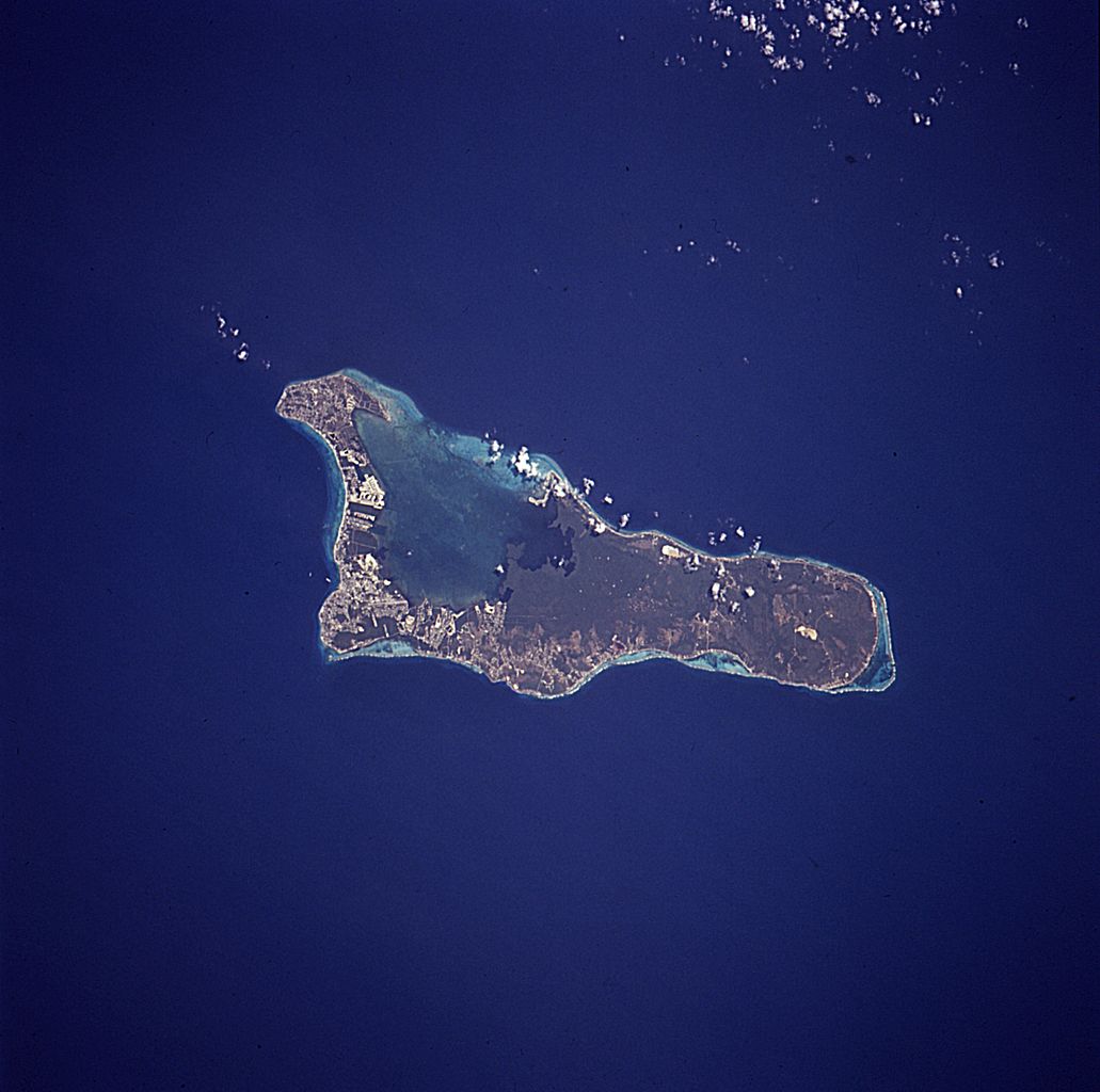
The island of
Grand Cayman
, a British dependency that covers 76 square miles (197 square kilometers) in the northwest Caribbean Sea, is visible in this near-vertical photograph. Geologically similar to The Bahamas, Grand Cayman is a low-lying, limestone island located on top of a submarine ridge. The city of George Town, the capital and chief port of the Cayman Islands, can be seen at the southwest end of the island. Grand Cayman’s 7-mile beach can be seen on the western side of the island.
The image was taken from an altitude of 115 nautical miles (213km); North is up in this image. |
|||||
| Date | April 15, 1994 18:38 (UTC?) | |||||
| Source | NASA, Astronaut Photography of Earth: Image STS059-227-42 . | |||||
| Author | NASA | |||||
|
Permission
( Reusing this file ) |
|

|
|
This image or video was catalogued by one of the centers of the United States
National Aeronautics and Space Administration
(NASA) under
Photo ID:
STS059-227-42
.
This tag does not indicate the copyright status of the attached work. A normal copyright tag is still required. See Commons:Licensing .
Other languages:
|