Great_Lakes_bathymetry_map.png
Size of this preview:
800 × 571 pixels
.
Other resolutions:
320 × 228 pixels
|
640 × 457 pixels
|
1,024 × 731 pixels
.
Summary
| Description |
English:
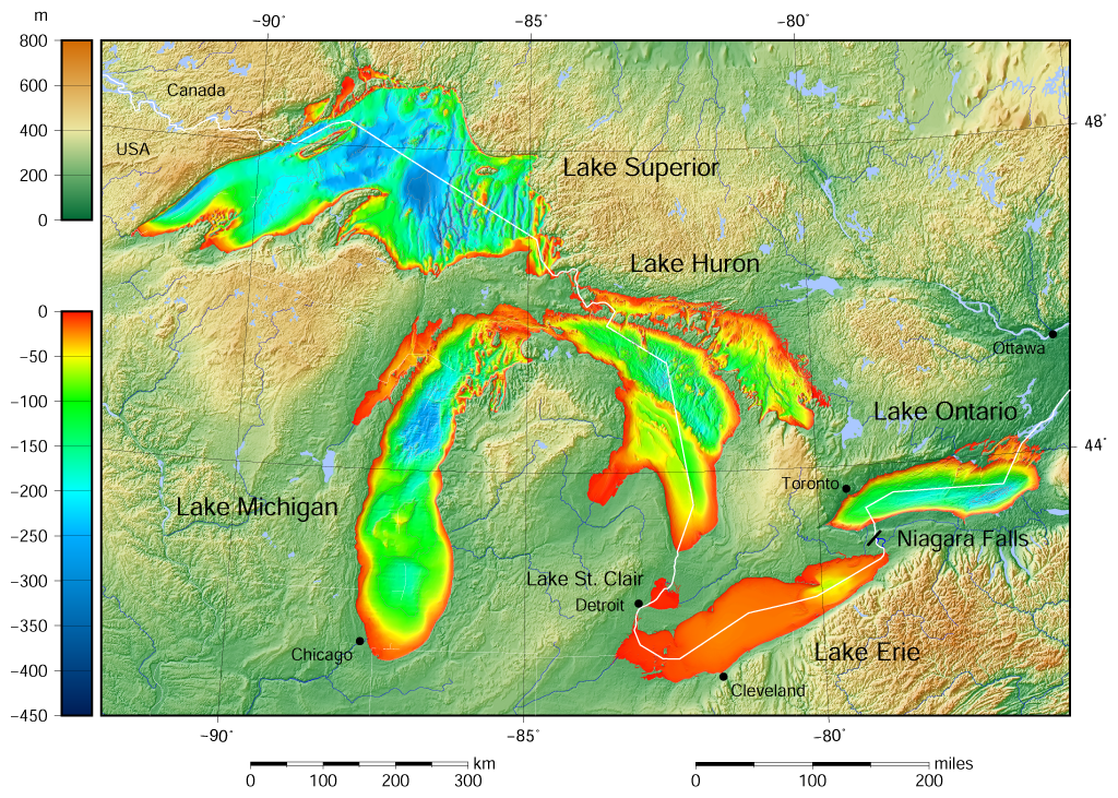
Great Lakes
bathymetry
and surrounding area shaded relief map. Lakes are contoured with interval 100 m.
Lake Superior is incomplete.
|
| Date | |
| Source |
Own work using: the following Public Domain datasets (grids):
The color palette of the depth scale was made to be more or less similar to the color palettes used on the NGDC Great Lakes maps. |
| Author | Darekk2 using the Great Lakes Bathymetry and GLOBE tiles |
| Other versions |
|

Licensing
Attribution (in addition to the author of this map):
The NGDC in it's
copyright notice
says:
As required by 17 U.S.C. 403, third parties producing copyrighted works consisting predominantly of the material produced by U.S. government agencies must provide notice with such work(s) identifying the U.S. Government material incorporated and stating that such material is not subject to copyright protection within the United States.
(...)
(for credits see the Source section).
This file is licensed under the
Creative Commons
Attribution-Share Alike 4.0 International
license.
Attribution:
The author of the work
and Great Lakes Bathymetry and GLOBE
(see above and the Source section)
and Great Lakes Bathymetry and GLOBE
(see above and the Source section)
-
You are free:
- to share – to copy, distribute and transmit the work
- to remix – to adapt the work
-
Under the following conditions:
- attribution – You must give appropriate credit, provide a link to the license, and indicate if changes were made. You may do so in any reasonable manner, but not in any way that suggests the licensor endorses you or your use.
- share alike – If you remix, transform, or build upon the material, you must distribute your contributions under the same or compatible license as the original.