Groundwater_flow.svg

Size of this PNG preview of this SVG file:
645 × 400 pixels
.
Other resolutions:
320 × 198 pixels
|
640 × 397 pixels
|
1,024 × 635 pixels
|
1,280 × 794 pixels
|
2,560 × 1,588 pixels
.
Summary
| Description |
English:
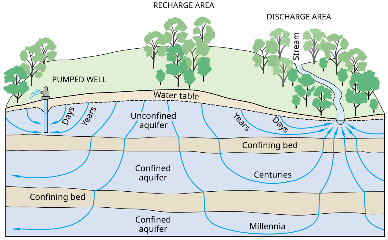
Ground-water flow paths vary greatly in length, depth, and traveltime from points of recharge to points of discharge in the groundwater system.
العربية:
تدفق المياه السطحية ضمن المسارات يختلف بشكل كبير من حيث الطول و العمق و زمن المسير من نقطة الدخول لإالى نقطة الخروج في نظام المياه السطحية.
|
| Date | |
| Source | Ground Water And Surface Water A Single Resource. U.S. Geological Survey Circular 1139 , Figure 3. |
| Author | T.C. Winter, J.W. Harvey, O.L. Franke, and W.M. Alley |
| SVG development |
This diagram was created with
Inkscape
, or with something else
.
This diagram uses
embedded
text that can be
easily translated
using a text editor.
|
Licensing
|
|
This image is in the
public domain
in the United States because it only contains materials that originally came from the
United States Geological Survey
, an agency of the
United States Department of the Interior
. For more information, see
the official USGS copyright policy
.
|
|