Hagupit_2014-12-04_0438Z.jpg

Size of this preview:
450 × 600 pixels
.
Other resolutions:
180 × 240 pixels
|
360 × 480 pixels
|
576 × 768 pixels
|
768 × 1,024 pixels
|
1,536 × 2,048 pixels
|
2,850 × 3,800 pixels
.
Summary
| Description |
English:
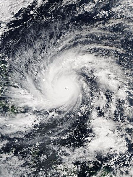
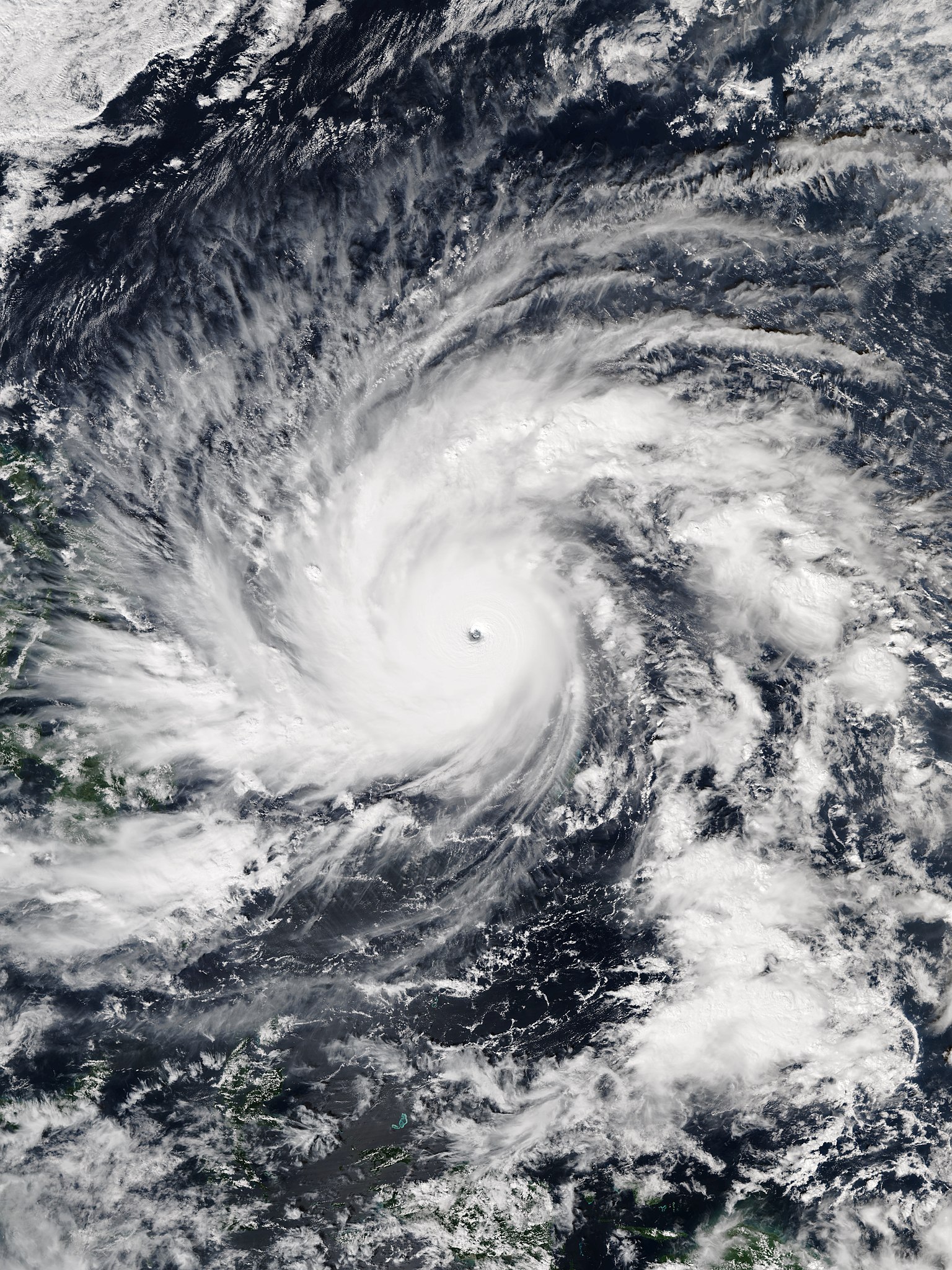
The Visible Infrared Imaging Radiometer Suite (VIIRS) sensor on Suomi-NPP captured this image of
Typhoon Hagupit
shortly before peak intensity on December 4, 2014, at 04:38 Universal Time.
|
| Date | |
| Source | http://www.nnvl.noaa.gov/view/#TRUE?timespan=daily&date=2014-12-04&lat=9.8291366906481&lon=129.82947841727&zoom=4 |
| Author | VIIRS imagery from the Suomi NPP satellite operated by the National Oceanic and Atmospheric Administration |
| Other versions |
|

| Camera location |
|
View this and other nearby images on: OpenStreetMap |
|
|---|
Licensing
|
|
This image is in the
public domain
because it contains materials that originally came from the U.S.
National Oceanic and Atmospheric Administration
, taken or made as part of an employee's official duties.
|
|