Hampshire_Administrative_Map_1832.png
Size of this preview:
568 × 599 pixels
.
Other resolutions:
228 × 240 pixels
|
455 × 480 pixels
|
728 × 768 pixels
|
971 × 1,024 pixels
|
2,000 × 2,109 pixels
.
Summary
| Description |
English:
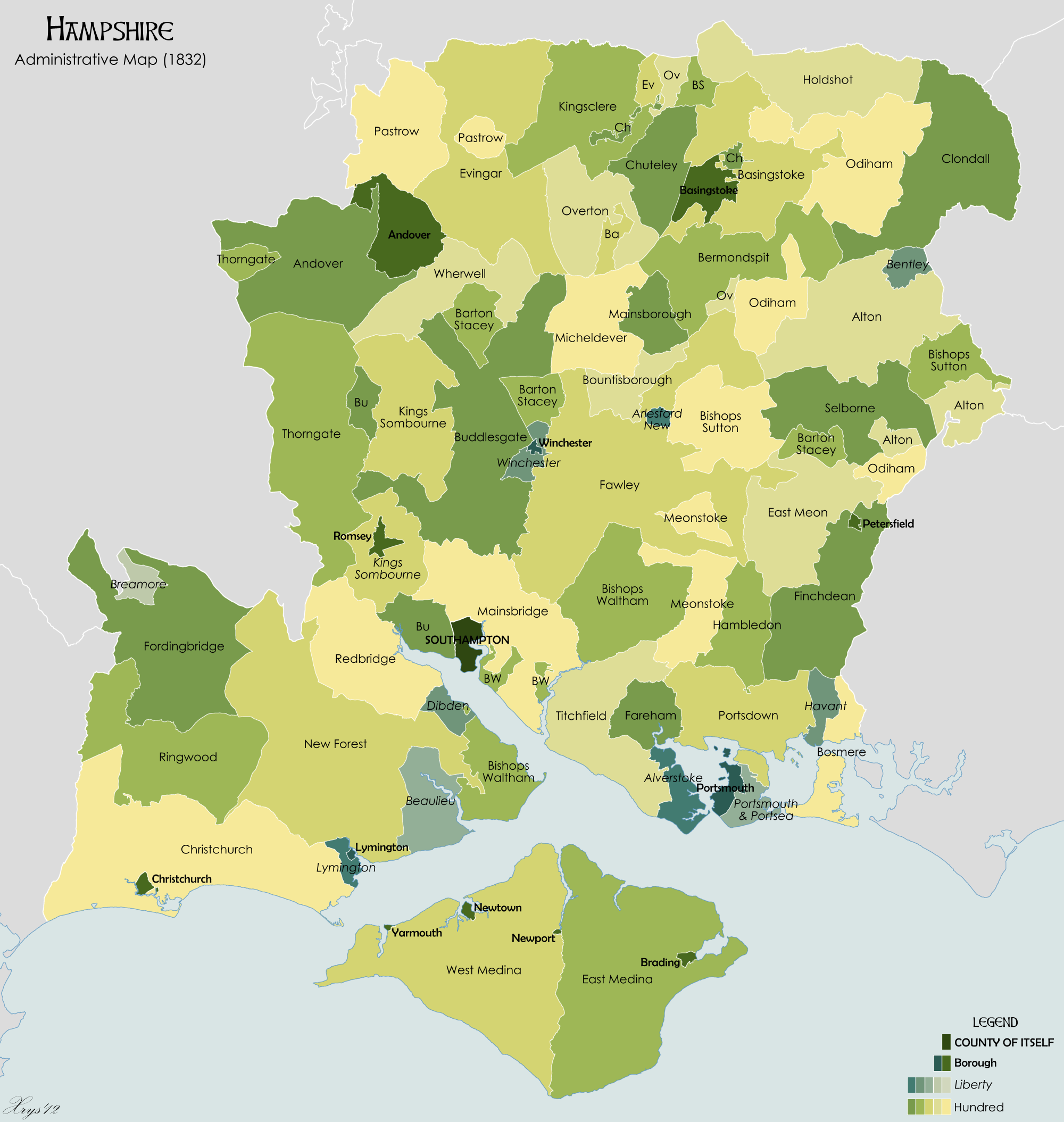
Administrative map of the ancient county of Hampshire in 1832. Showing Hundreds, Liberties, extant Boroughs and the County of the City of Southampton. Source data for parish boundaries - Kain, R.J.P., and Oliver, R.R. (2001) "Historic parishes of England and Wales". Unit names from Vision of Britain website.
|
| Date | |
| Source | Own work |
| Author | XrysD |
Licensing
I, the copyright holder of this work, hereby publish it under the following license:
This file is licensed under the
Creative Commons
Attribution-Share Alike 3.0 Unported
license.
-
You are free:
- to share – to copy, distribute and transmit the work
- to remix – to adapt the work
-
Under the following conditions:
- attribution – You must give appropriate credit, provide a link to the license, and indicate if changes were made. You may do so in any reasonable manner, but not in any way that suggests the licensor endorses you or your use.
- share alike – If you remix, transform, or build upon the material, you must distribute your contributions under the same or compatible license as the original.