Hanover1720.png
Size of this preview:
707 × 600 pixels
.
Other resolutions:
283 × 240 pixels
|
566 × 480 pixels
|
906 × 768 pixels
|
1,208 × 1,024 pixels
|
2,500 × 2,120 pixels
.

|
This
map
image could be re-created
using
vector graphics
as an
SVG
file
. This has several advantages; see
Commons:Media for cleanup
for more information. If an SVG form of this image is available, please upload it and afterwards replace this template with
{{

vector version available

|

new image name

}}
.
It is recommended to name the SVG file “Hanover1720.svg”—then the template Vector version available (or Vva ) does not need the new image name parameter. |
Summary
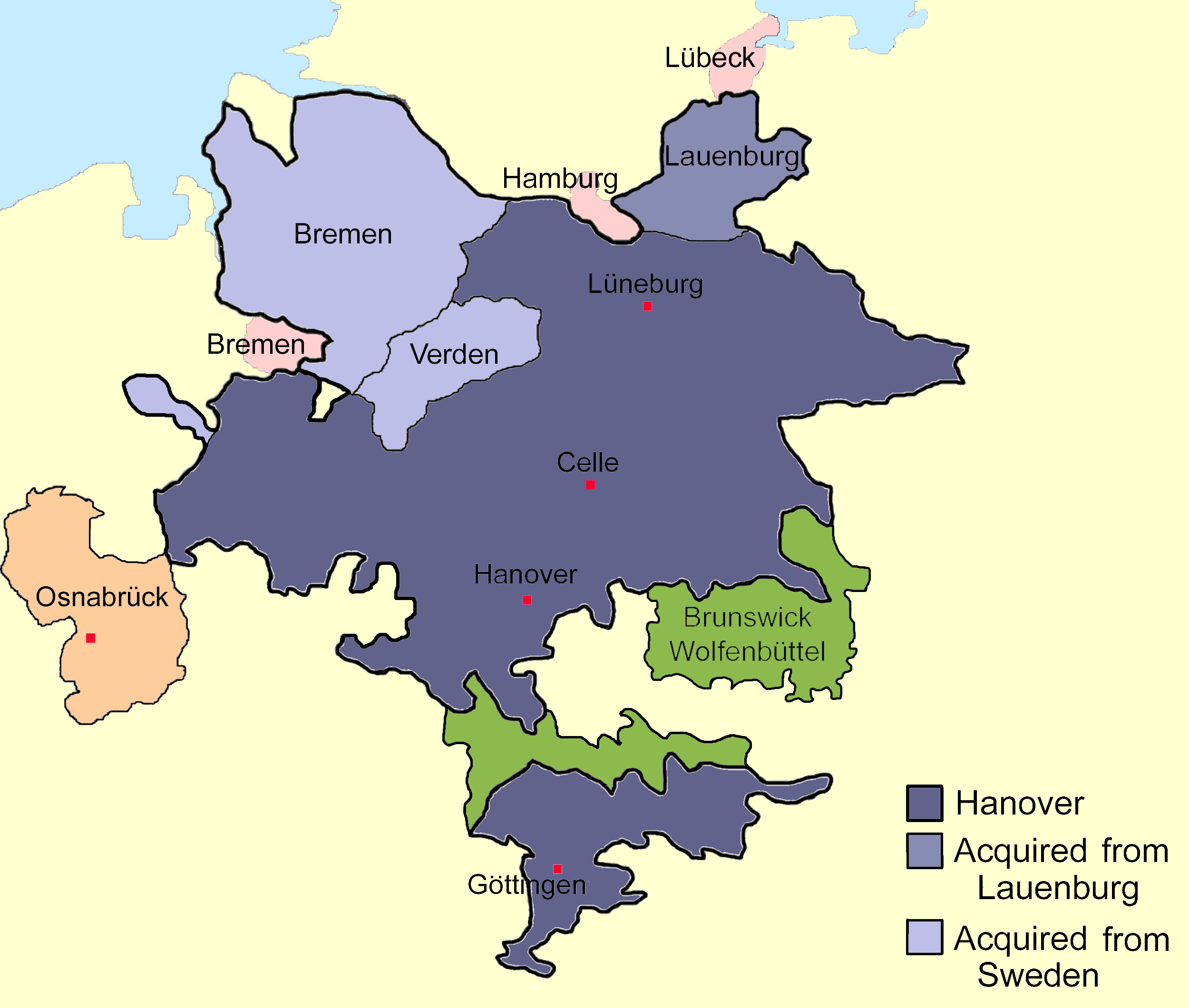
| Description | Sketch map of the state of Hanover, c.1720 showing territorial acquisitions and some neighbouring states and imperial cities; drawn in Adobe Photoshop by hand using a pen tablet. |
| Date | Unknown date |
| Source |
Own work Based on Map 1, page 378, Hatton, Ragnhild (1978) George I: Elector and King , Cambridge, MA: Harvard University Press ISBN : 0-674-34935-0 . |
| Author | DrKay |
| Other versions |
|


|
|
I, the copyright holder of this work, release this work into the
public domain
. This applies worldwide.
In some countries this may not be legally possible; if so: I grant anyone the right to use this work for any purpose , without any conditions, unless such conditions are required by law. |