Historic_Triangle_Virginia.jpg
Size of this preview:
800 × 532 pixels
.
Other resolutions:
320 × 213 pixels
|
640 × 426 pixels
|
1,024 × 681 pixels
|
1,280 × 851 pixels
|
2,923 × 1,944 pixels
.
Summary

|
This
road map
image could be re-created
using
vector graphics
as an
SVG
file
. This has several advantages; see
Commons:Media for cleanup
for more information. If an SVG form of this image is available, please upload it and afterwards replace this template with
{{

vector version available

|

new image name

}}
.
It is recommended to name the SVG file “Historic Triangle Virginia.svg”—then the template Vector version available (or Vva ) does not need the new image name parameter. |


| Description |
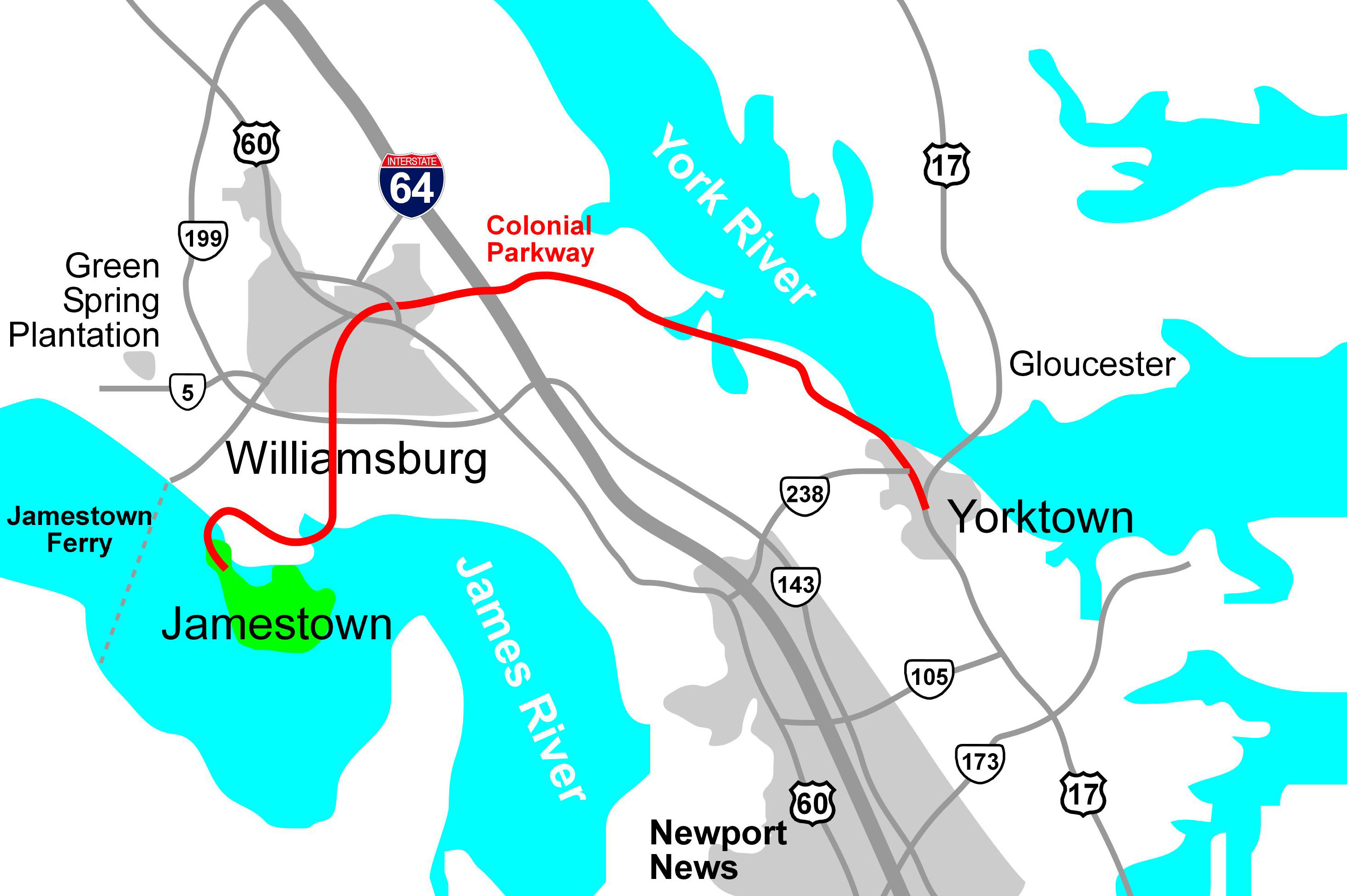
English:
Map of the
Colonial Parkway
, a National Scenic Byway within
Colonial National Historical Park
in Virginia, drawn in Macromedia Freehand.
|
| Date | 30 January 2006 (original upload date) |
| Source | Derived from source file available in http://posix.com/CWmaps , although it is about today's Virginia, not the Civil War |
| Author | Hal Jespersen at en.wikipedia |
|
Permission
( Reusing this file ) |
Released into the public domain (by the author). |
| Other versions | File:Historic Triangle Virginia PNG.png |
Licensing
|
|
This work has been released into the
public domain
by its author,
Hal Jespersen
, at the
English Wikipedia
project
. This applies worldwide.
In case this is not legally possible:
|
Original upload log
The original description page was
here
. All following user names refer to en.wikipedia.
- 2006-01-30 22:25 Hlj 2923×1944× (538422 bytes) Updated the image to correct the location of Green Spring Plantation.
- 2005-10-19 15:50 Hlj 2824×1933× (492287 bytes) Drawn by Hal Jespersen in Macromedia Freehand. Source file available in http://posix.com/CWmaps (although it is about modern Virginia, not the Civil War).