Hittite_Empire.png
No higher resolution available.
Summary
| Description |
English:
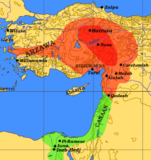
The maximal extent of the Hittite Empire ca. 1300 BC is shown in orange, the Egyptian sphere of influence in green. The approximate extent of the Hittite Old Kingdom under Hantili I (ca. 1590 BC) is shown in red.
|
| Date | |
| Source | Own work based on: Hitt Egypt Perseus.png and Orient 27 43 22 55 blank map.png |
| Author | Dbachmann |

|
File:Hititas 1300 adC.svg
is a vector version of this file. It should be used in place of this PNG file when not inferior.
File:Hittite Empire.png →
File:Hititas 1300 adC.svg
For more information, see
Help:SVG
.
|

|
Licensing

|
Permission is granted to copy, distribute and/or modify this document under the terms of the GNU Free Documentation License , Version 1.2 or any later version published by the Free Software Foundation ; with no Invariant Sections, no Front-Cover Texts, and no Back-Cover Texts. A copy of the license is included in the section entitled GNU Free Documentation License . |
|
|
This file is licensed under the Creative Commons Attribution-Share Alike 3.0 Unported license. | |
|
||
| This licensing tag was added to this file as part of the GFDL licensing update . |