Hokianga.jpg
Size of this preview:
800 × 544 pixels
.
Other resolutions:
320 × 218 pixels
|
640 × 436 pixels
|
1,024 × 697 pixels
|
1,152 × 784 pixels
.
Summary
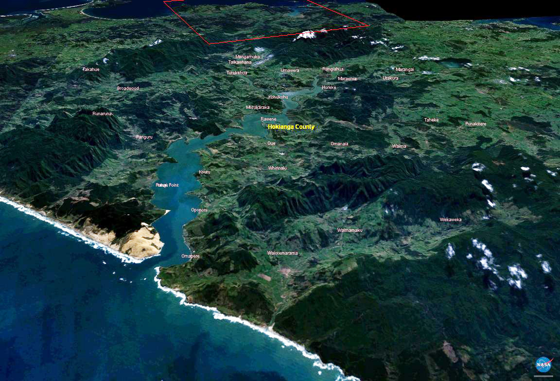
This is a screenshot from the NASA World Wind program, modified by me to remove an artifact. It depicts the Hokianga area of Northland, New Zealand. The screenshot was made on February 27, 2005, and the satellite data used by World Wind was presumably up to date. - Gadfium 05:35, 27 Feb 2005 (UTC)
Licensing
|
|
This image is in the
public domain
because it is a screenshot from
NASA
’s globe software
World Wind
using a public domain layer, such as Blue Marble, MODIS, Landsat, SRTM, USGS or GLOBE.
|

|
Original upload log
The original description page was
here
. All following user names refer to en.wikipedia.
- 2006-05-15 00:16 Kahuroa 1152×784× (276842 bytes) This is an edited version of Hokianga.jpg from the Wikimedia Commons. ~~~~ Here is the description provided by the original uploader: This is a screenshot from the NASA World Wind program, modified by me to remove an artifact. It depicts the Hokianga ar