Holt_Heath_-_geograph.org.uk_-_1060817.jpg
No higher resolution available.
Summary
| Description |
English:
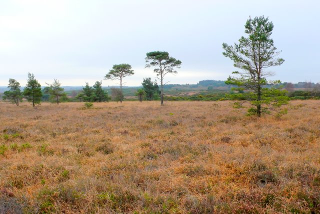
Holt Heath The bracken on this, one of the few remaining pieces of genuine Dorset heathland, turns golden brown in winter as it dies off and the only greenery to be seen are the evergreen trees and the gorse (furze) bushes which were the original source of firewood for the poor commoners who lived on the heath for many hundreds of years up until the end of the 19thC.
|
| Date | |
| Source | From geograph.org.uk |
| Author | Nigel Mykura |
|
Attribution
( required by the license ) |
Nigel Mykura / Holt Heath / |
| Camera location |
|
View this and other nearby images on: OpenStreetMap |
|
|---|
_heading:202.00&language=en)
| Object location |
|
View this and other nearby images on: OpenStreetMap |
|
|---|
_heading:202.00&language=en)
Licensing

|
This image was taken from the
Geograph project
collection. See
this photograph's page
on the Geograph website for the photographer's contact details. The copyright on this image is owned by
Nigel Mykura
and is licensed for reuse under the
Creative Commons
Attribution-ShareAlike 2.0 license.
|
This file is licensed under the
Creative Commons
Attribution-Share Alike 2.0 Generic
license.
Attribution:
Nigel Mykura
-
You are free:
- to share – to copy, distribute and transmit the work
- to remix – to adapt the work
-
Under the following conditions:
- attribution – You must give appropriate credit, provide a link to the license, and indicate if changes were made. You may do so in any reasonable manner, but not in any way that suggests the licensor endorses you or your use.
- share alike – If you remix, transform, or build upon the material, you must distribute your contributions under the same or compatible license as the original.