Hull_Gut_Map.jpg
No higher resolution available.
Summary
| Description |
English:
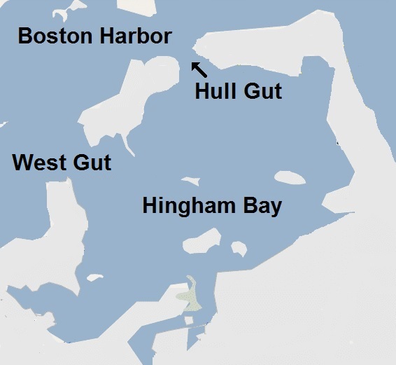
Simplistic map of area of Hull Gut (including parts of Hull and Quincy and Hingham Harbor). Only the coastline is shown, and there are some labels.
|
| Date | Don't know. I created this highly modified verson on April 10 2014 |
| Source | http://wikimapia.org/#lang=en&lat=42.282135&lon=-70.900784&z=13&m=w |
| Author | Wikimapia |
|
Permission
( Reusing this file ) |
It says "CC BY SA" at the bottom of the page http://wikimapia.org/#lang=en&lat=42.282135&lon=-70.900784&z=13&m=w |
- Other information
It's extensively modified (by me) from the free source.
Licensing
This file is licensed under the
Creative Commons
Attribution-Share Alike 3.0 Unported
license.
-
You are free:
- to share – to copy, distribute and transmit the work
- to remix – to adapt the work
-
Under the following conditions:
- attribution – You must give appropriate credit, provide a link to the license, and indicate if changes were made. You may do so in any reasonable manner, but not in any way that suggests the licensor endorses you or your use.
- share alike – If you remix, transform, or build upon the material, you must distribute your contributions under the same or compatible license as the original.