Hungary_map_1941.png

Size of this preview:
800 × 578 pixels
.
Other resolutions:
320 × 231 pixels
|
640 × 462 pixels
|
1,022 × 738 pixels
.
Summary
| Description |
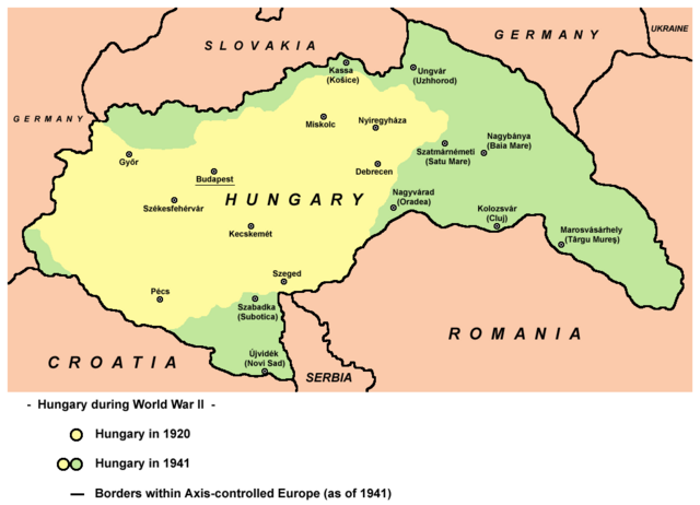
English:
Hungary in 1920 and in 1941.
|
| Date | |
| Source | Own work |
| Author | User:PANONIAN |
| Other versions |
Derivative works of this file: |
References
- The Times History of Europe, Times Books, London, 2002.
- Richard Overy, The Times History of the 20th Century, Times Books, London, 2004.
- Peter Rokai - Zoltan Đere - Tibor Pal - Aleksandar Kasaš, Istorija Mađara, Beograd, 2002.
- http://terkepek.adatbank.transindex.ro/kepek/netre/224.gif
- http://www.hunmagyar.org/tor/terkep.jpg
- http://www.map.hu/galeria/orig/1426_hu_in_maps_fig_12_states_1648-2009.jpg archive copy at the Wayback Machine
Licensing
|
|
This work has been released into the
public domain
by its author,
PANONIAN
. This applies worldwide.
In some countries this may not be legally possible; if so:
|

|
This map has been uploaded by
Electionworld
from en.wikipedia.org to enable the
|