IJsselmonde_osm.png

Size of this preview:
800 × 546 pixels
.
Other resolutions:
320 × 219 pixels
|
640 × 437 pixels
|
1,024 × 699 pixels
|
1,356 × 926 pixels
.
Summary
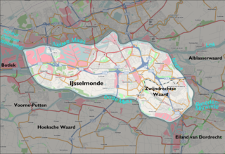
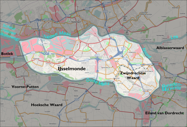
| Description | Map of the IJsselmonde 'island' south of Rotterdam (Netherlands). The background map is taken from Openstreetmap.org. The boundary was drawn by me using the description in the Dutch IJsselmonde article. |
| Date | |
| Source | Openstreetmap.org ( [1] ) + own work |
| Author | Contributors of the relevant openstreetmap.org data + Mtcv |
|
Permission
( Reusing this file ) |
CC-BY-SA-2.0 |
Licensing
This file is licensed under the
Creative Commons
Attribution-Share Alike 2.0 Generic
license.
-
You are free:
- to share – to copy, distribute and transmit the work
- to remix – to adapt the work
-
Under the following conditions:
- attribution – You must give appropriate credit, provide a link to the license, and indicate if changes were made. You may do so in any reasonable manner, but not in any way that suggests the licensor endorses you or your use.
- share alike – If you remix, transform, or build upon the material, you must distribute your contributions under the same or compatible license as the original.