ILS_diagramsimplified.png
Size of this preview:
800 × 419 pixels
.
Other resolutions:
320 × 167 pixels
|
640 × 335 pixels
|
1,024 × 536 pixels
|
1,468 × 768 pixels
.
Summary
| Description |
English:
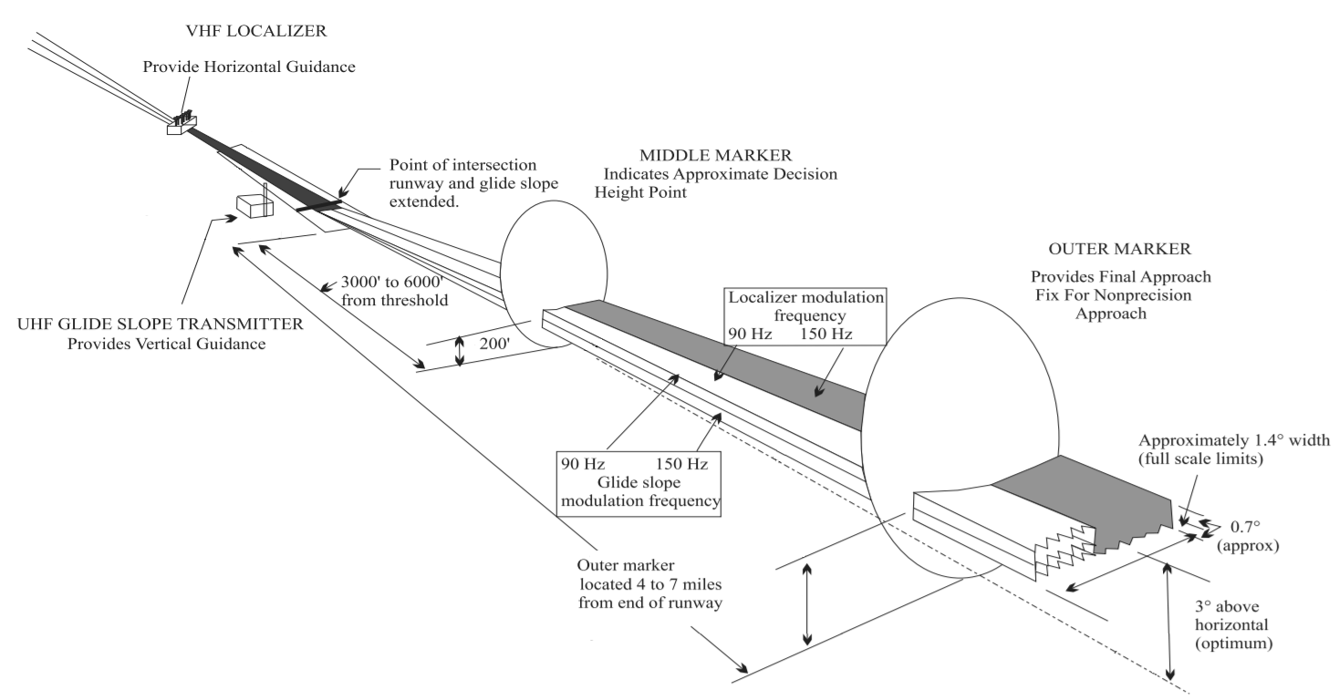
FAA Instrument Landing Systems
|
| Date | |
| Source | Aeronautical Information Manual, https://www.faa.gov/air_traffic/publications/media/AIM_Basic_dtd_10-12-17.pdf |
| Author | U.S. Dept. of Transportation, Federal Aviation Administration, |
| Other versions |


|
This
transport map
image could be re-created
using
vector graphics
as an
SVG
file
. This has several advantages; see
Commons:Media for cleanup
for more information. If an SVG form of this image is available, please upload it and afterwards replace this template with
{{

vector version available

|

new image name

}}
.
It is recommended to name the SVG file “ILS diagramsimplified.svg”—then the template Vector version available (or Vva ) does not need the new image name parameter. |
Licensing
|
|
This image or file is a work of a
Federal Aviation Administration
employee, taken or made as part of that person's official duties. As a
work
of the
U.S. federal government
, the image is in the
public domain
in the United States.
|

|