Ilha_do_Fogo_aerial_shot_1.jpg
Size of this preview:
800 × 600 pixels
.
Other resolutions:
320 × 240 pixels
|
640 × 480 pixels
|
1,024 × 768 pixels
|
1,280 × 960 pixels
|
2,560 × 1,920 pixels
|
3,072 × 2,304 pixels
.
Summary
| Description |
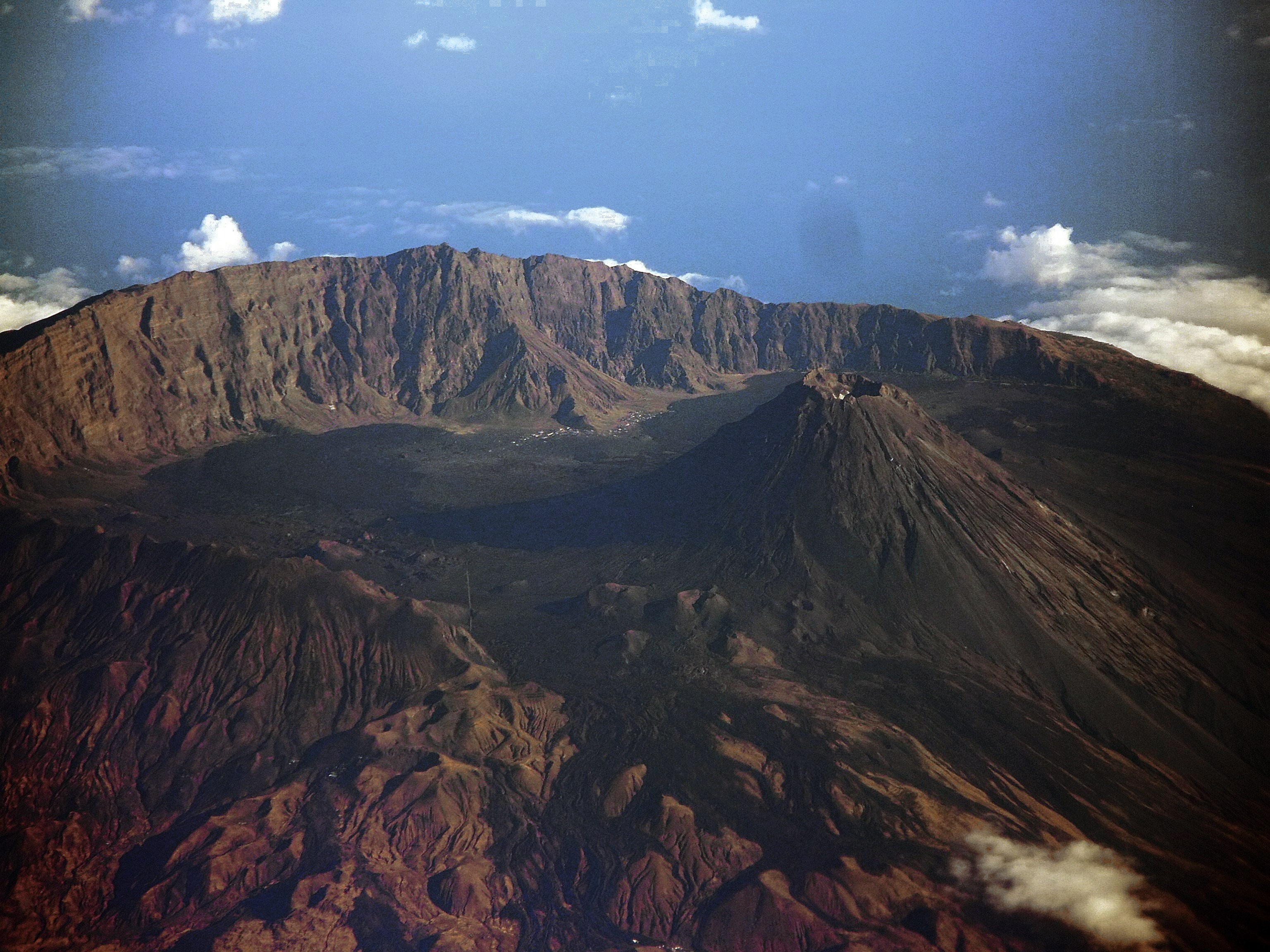
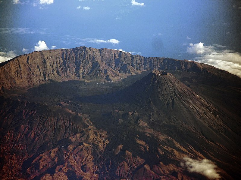
English:
Fogo island
aerial shot taken from an Airbus cockpit
Português:
Foto aérea da
Ilha do Fogo
tirada da cabine do piloto de um Airbus
|
| Date | |
| Source | The author himself gave me permission to publish here as freely distributable |
| Author | Aldo Bien |
|
Permission
( Reusing this file ) |
Creative Commons Attribution-Share Alike 3.0 |
| Camera location |
|
View this and other nearby images on: OpenStreetMap |
|
|---|
Licensing
This file is licensed under the
Creative Commons
Attribution-Share Alike 3.0 Unported
license.
-
You are free:
- to share – to copy, distribute and transmit the work
- to remix – to adapt the work
-
Under the following conditions:
- attribution – You must give appropriate credit, provide a link to the license, and indicate if changes were made. You may do so in any reasonable manner, but not in any way that suggests the licensor endorses you or your use.
- share alike – If you remix, transform, or build upon the material, you must distribute your contributions under the same or compatible license as the original.