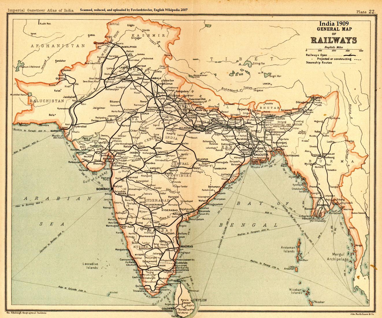
India_railways1909a.jpg
Size of this preview:
719 × 600 pixels
.
Other resolutions:
288 × 240 pixels
|
575 × 480 pixels
|
921 × 768 pixels
|
1,227 × 1,024 pixels
|
1,322 × 1,103 pixels
.
Summary
| Description |
English:
A general map of Indian railways, 1909. Scanned and reduced from personal copy of Imperial Gazetteer of India, volume 25
(Atlas), Oxford University Press, 1909, by
Fowler&fowler
«Talk»
05:05, 18 September 2007 (UTC)
|
|||||||||
| Date | ||||||||||
| Source | Imperial Gazetteer of India, 1909 | |||||||||
| Creator |
John Bartholomew and Company/Edinburgh Geographical Institute
|
|||||||||
| Geotemporal data | ||||||||||
| Bounding box |
|
|||||||||
| Georeferencing | ||||||||||
Licensing
|
|
This work
created by the United Kingdom Government
is in the
public domain
.
This is because it is one of the following :
HMSO has declared that the expiry of Crown Copyrights applies worldwide (ref:
HMSO Email Reply
)
|

|
Original upload log
The original description page was
here
. All following user names refer to en.wikipedia.
- 2007-09-18 05:05 Fowler&fowler 1322×1103× (344309 bytes) Scanned and reduced from personal copy of Imperial Gazetteer of India, volume 25 (Atlas), Oxford University Press, 1909, by ~~~~ {{PD-US-1923-abroad}}