IndianTerritory1885.jpg

Size of this preview:
792 × 600 pixels
.
Other resolutions:
317 × 240 pixels
|
634 × 480 pixels
|
1,015 × 768 pixels
|
1,321 × 1,000 pixels
.
Summary
| Description |
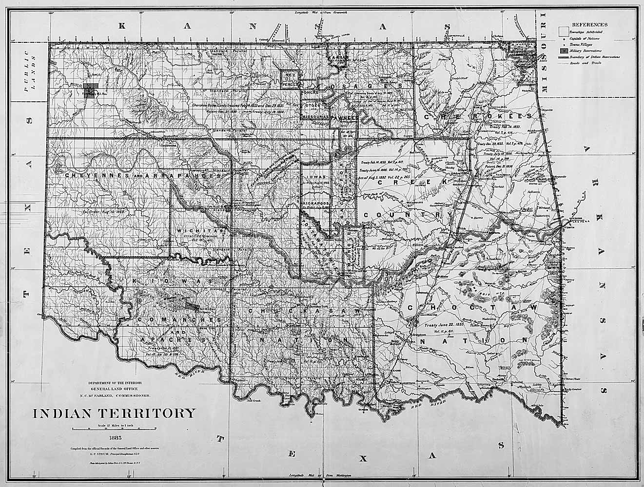
English:
Map of Indian territory in Oklahoma in 1885.
|
| Date | |
| Source |
National Archives Federal Indian Policy , direct image here . Source claims the image is available in ARC with identifier NWDC-49-STP-IT1885, but cannot find it. |
| Author | General Land Office, U.S. Department of the Interior |
Licensing
|
|
This image or media file contains material based on a work of a United States Department of the Interior employee, created as part of that person's official duties. As a work of the U.S. federal government , such work is in the public domain in the United States. See the Department of the Interior copyright policy for more information. |

|