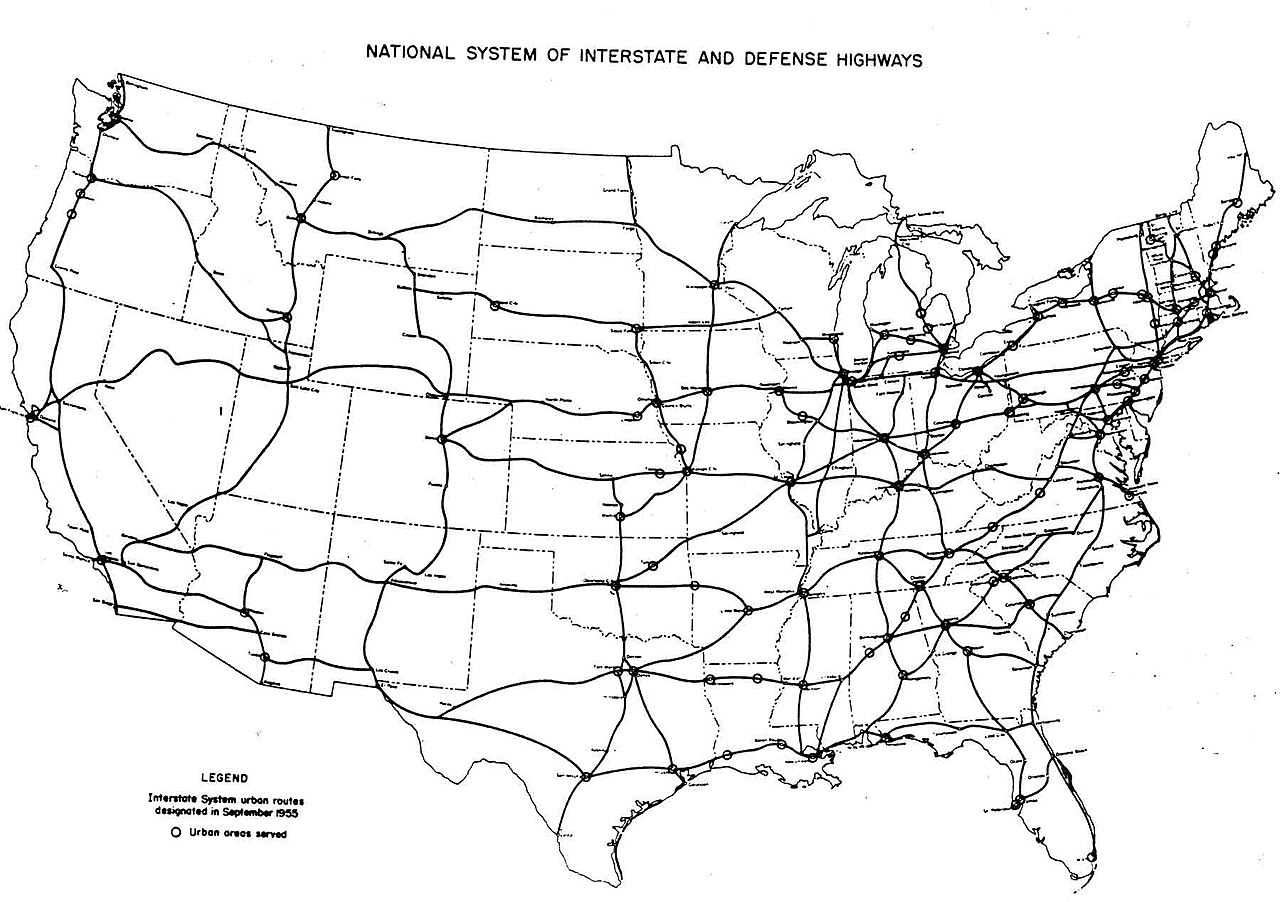
Bureau of Public Roads (September 1955). "National System of Interstate and Defense Highways" (Map). General Location of National System of Interstate Highways Including All Additional Routes at Urban Areas Designated in September 1955 Scale not given. Washington, DC: Government Printing Office. p. i. OCLC 4165975 . The Bureau of Public Roads (BPR) was originally a part of the United States Department of Agriculture then the United States Department of Commerce . The BPR is the predecessor agency to the Federal Highway Administration , a part of the United States Department of Transportation .
This tag does not indicate the copyright status of the attached work. A normal copyright tag is still required. See Commons:Licensing for more information.
Deutsch ∙ English ∙ Tiếng Việt ∙ македонски ∙ русский ∙ українська ∙ 日本語 ∙ +/−


