IslamicConquestsIroon.png
Size of this preview:
675 × 599 pixels
.
Other resolutions:
270 × 240 pixels
|
541 × 480 pixels
|
1,006 × 893 pixels
.

|
This
historical map
image could be re-created
using
vector graphics
as an
SVG
file
. This has several advantages; see
Commons:Media for cleanup
for more information. If an SVG form of this image is available, please upload it and afterwards replace this template with
{{

vector version available

|

new image name

}}
.
It is recommended to name the SVG file “IslamicConquestsIroon.svg”—then the template Vector version available (or Vva ) does not need the new image name parameter. |
| Description |
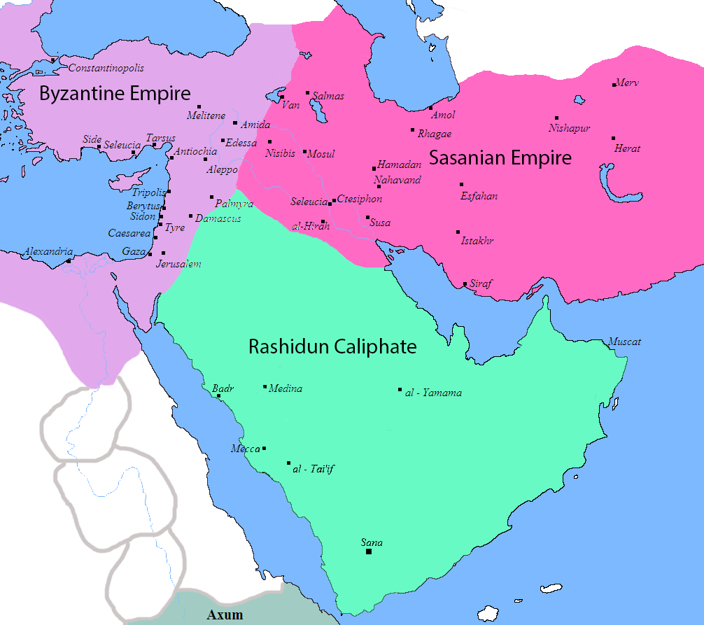
English:
Map of the Sassanid, Byzantine and Muslim borders.
|
| Source | File:Pre_Islamic_Arabia.PNG |
| Author | Javierfv1212 and edited by HistoryofIran. |
| Other versions |
[
]
|


|
|
This file is in the
public domain
because
File:Pre_Islamic_Arabia.PNG
|