Isle_of_Anglesey_Wales_communities_-_Rhosyr_locator.png
Size of this preview:
632 × 599 pixels
.
Other resolutions:
253 × 240 pixels
|
506 × 480 pixels
|
810 × 768 pixels
.
Summary
| Description |
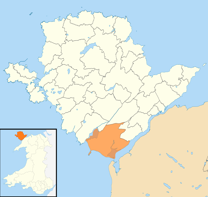
English:
Location map of the community (civil parish) of Rhosyr in Ynys Môn / Anglesey, Wales.
|
| Date | |
| Source |
This file was derived from:
Isle of Anglesey UK community map (blank).svg
|
| Author | Sionk |
.svg)

|
File:Wales Anglesey Community Rhosyr map.svg
is a vector version of this file. It should be used in place of this PNG file when not inferior.
File:Isle of Anglesey Wales communities - Rhosyr locator.png →
File:Wales Anglesey Community Rhosyr map.svg
For more information, see
Help:SVG
.
|

|
Licensing
This file is licensed under the
Creative Commons
Attribution-Share Alike 3.0 Unported
license.
Attribution:
Contains Ordnance Survey data © Crown copyright and database right
-
You are free:
- to share – to copy, distribute and transmit the work
- to remix – to adapt the work
-
Under the following conditions:
- attribution – You must give appropriate credit, provide a link to the license, and indicate if changes were made. You may do so in any reasonable manner, but not in any way that suggests the licensor endorses you or your use.
- share alike – If you remix, transform, or build upon the material, you must distribute your contributions under the same or compatible license as the original.