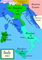
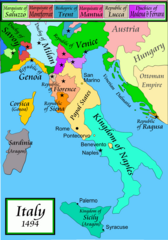
Italy_1494_AD.png

Size of this preview:
419 × 600 pixels
.
Other resolutions:
168 × 240 pixels
|
335 × 480 pixels
|
536 × 768 pixels
|
1,261 × 1,805 pixels
.


|
File:Italy 1494 AD-it.svg
is a vector version of this file. It should be used in place of this PNG file when not inferior.
File:Italy 1494 AD.png →
File:Italy 1494 AD-it.svg
For more information, see
Help:SVG
.
|

|
Summary
Political map of Italy in early 1494, before the invasion of Italy by Charles VIII of France , created by MapMaster.
Part of a series of maps on the history of Italy:
-
 1000 AD
 -
 1084 AD
 -
 1796 AD
 -
 1810 AD


Versions
[
]
PNG:
-
 Arabic
 -
 English
 -
 Greek
Greek


SVG:
-
 French
 -
 Italian
 -
 Hungarian


References
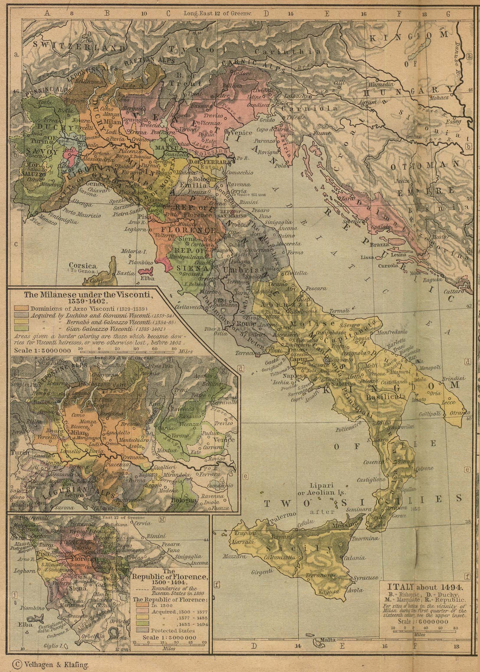
- Bjorklund, Oddvar; Holmboe, Haakon; Rohr, Anders (1970) Historical Atlas of the World , Barnes & Noble, NY, SBN: 389-00253-4.
- Matthew, Donald, (1983), Atlas of Medieval Europe , Checkmark Books, New York.
- Online maps, including this 1882 map from Shepherd (the University of Texas)
- this one from A B Longman, textbook publisher .
Licensing
I, the copyright holder of this work, hereby publish it under the following licenses:

|
Permission is granted to copy, distribute and/or modify this document under the terms of the GNU Free Documentation License , Version 1.2 or any later version published by the Free Software Foundation ; with no Invariant Sections, no Front-Cover Texts, and no Back-Cover Texts. A copy of the license is included in the section entitled GNU Free Documentation License . |
|
|
This file is licensed under the Creative Commons Attribution-Share Alike 3.0 Unported license. | |
|
||
| This licensing tag was added to this file as part of the GFDL licensing update . |
You may select the license of your choice.
derivative works
Derivative works of this file: Italy 1494 AD-ar.png