JerusalemWest1870s.jpg
No higher resolution available.
Summary
| Description |
English:
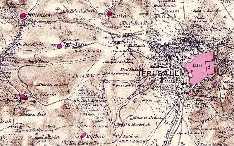
Portion of map produced by the Survey of Western Palestine, first published in 1880 by the Committee of the Palestine Exploration Fund. The editor, Walter Besant, died in 1901.
|
| Date | |
| Source |
Palestine Exploration Fund map, sheet 17.
Map of survey carried out between 1871 and 1878 by the Palestine Exploration Fund, published in 26 sections in 1880 . |
| Author | Walter Besant, died in 1901 |
Licensing
|
This is a faithful photographic reproduction of a two-dimensional,
public domain
work of art. The work of art itself is in the public domain for the following reason:
The official position taken by the Wikimedia Foundation is that "
faithful reproductions of two-dimensional public domain works of art are public domain
".
This photographic reproduction is therefore also considered to be in the public domain in the United States. In other jurisdictions, re-use of this content may be restricted; see Reuse of PD-Art photographs for details. |
||||