Jezero_crater_—_the_landing_site_for_NASA’s_Mars_2020_mission.png

Size of this preview:
800 × 562 pixels
.
Other resolutions:
320 × 225 pixels
|
640 × 449 pixels
|
1,024 × 719 pixels
|
1,280 × 899 pixels
|
2,560 × 1,797 pixels
|
3,276 × 2,300 pixels
.
Summary
| Description |
English:
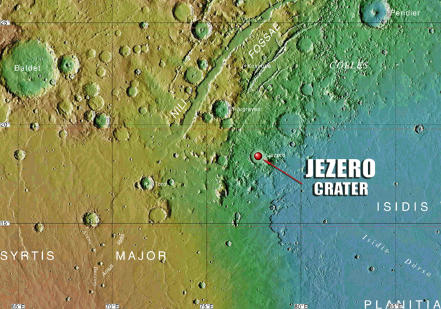
This cropout from the MC-13 quadrangle map of Mars displays the Jezero crater, known as the landing site for the rover Perseverance as part of NASA’s Mars 2020 mission. This topographical map is based on data from the Mars Orbiter Laser Altimeter (MOLA), an instrument on NASA’s Mars Global Surveyor (MGS) spacecraft.
Image credit: USGS, NASA
|
| Date | |
| Source | https://pubs.usgs.gov/imap/i2782/i2782_sh1.pdf |
| Author | U.S. Geological Survey |
Licensing
|
|
This image is in the
public domain
in the United States because it only contains materials that originally came from the
United States Geological Survey
, an agency of the
United States Department of the Interior
. For more information, see
the official USGS copyright policy
.
|
|
|
|
This file is in the public domain in the United States because it was solely created by NASA . NASA copyright policy states that "NASA material is not protected by copyright unless noted ". (See Template:PD-USGov , NASA copyright policy page or JPL Image Use Policy .) |
|

|
Warnings:
|