Joan_of_Arc_Roen_Burning_place_IMG_1602.JPG

Size of this preview:
450 × 600 pixels
.
Other resolutions:
180 × 240 pixels
|
360 × 480 pixels
|
576 × 768 pixels
|
768 × 1,024 pixels
|
1,536 × 2,048 pixels
|
3,000 × 4,000 pixels
.
Summary
| Camera location |
|
View this and other nearby images on: OpenStreetMap |
|
|---|
| Description |
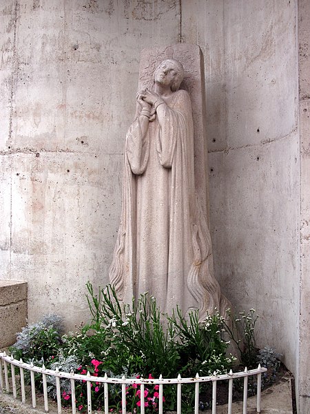
Русский:
Жанна д'Арк. Место сожжения в Руане
English:
Statue of Joan of Arc in Rouen, very near the place where she was burnt at the stake in 1431.
|
| Date | |
| Source | Own work |
| Author | Владимир Шеляпин |
Licensing
I, the copyright holder of this work, hereby publish it under the following license:
This file is licensed under the
Creative Commons
Attribution-Share Alike 3.0 Unported
license.
-
You are free:
- to share – to copy, distribute and transmit the work
- to remix – to adapt the work
-
Under the following conditions:
- attribution – You must give appropriate credit, provide a link to the license, and indicate if changes were made. You may do so in any reasonable manner, but not in any way that suggests the licensor endorses you or your use.
- share alike – If you remix, transform, or build upon the material, you must distribute your contributions under the same or compatible license as the original.