Kaliningrad_05-2017_img10_aerial_view.jpg

Size of this preview:
800 × 500 pixels
.
Other resolutions:
320 × 200 pixels
|
640 × 400 pixels
|
1,024 × 640 pixels
|
1,280 × 800 pixels
|
2,560 × 1,600 pixels
|
4,314 × 2,696 pixels
.
| Description |
English:
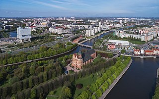
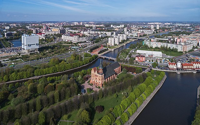
Aerial photo, in the foreground: historical Lutheran cathedral in Kaliningrad formerly Königsberg, Kaliningrad Oblast, Russia.
Deutsch:
Luftaufnahme, im Vordergrund: ehemaliger Dom in Kaliningrad ehem. Königsberg / Kaliningrader Gebiet, Russland.
Русский:
Аэрофотосъёмка города, на переднем плане: исторический кафедральный собор на острове Канта в Калининграде, Россия.
|
| Date | |
| Source | Own work |
| Author | A.Savin |
|
Permission
( Reusing this file ) |
.svg)
Just attribute the author: « A.Savin, Wikipedia »; if you have questions —
Telegram
, or e-mail to
[email protected]
.
.svg)
Просто укажите в качестве автора: « А.Савин, Википедия »; если есть вопрос —
телеграм
, или эл.почта на
[email protected]
.

Kennzeichnen Sie einfach als Autor: « A.Savin, Wikipedia »; falls Sie Fragen haben —
Telegram
, oder E-Mail an
[email protected]
.
Thank you. |
| Camera location |
|
View this and other nearby images on: OpenStreetMap |
|
|---|
Licensing
|
|
Copyleft: This work of art is free; you can redistribute it and/or modify it according to terms of the Free Art License . You will find a specimen of this license on the Copyleft Attitude site as well as on other sites . |