Kanaga_Volcano_(22432739869).jpg

Size of this preview:
800 × 600 pixels
.
Other resolutions:
320 × 240 pixels
|
640 × 480 pixels
|
1,024 × 768 pixels
|
1,280 × 960 pixels
|
2,560 × 1,920 pixels
|
3,264 × 2,448 pixels
.
Summary
| Description |
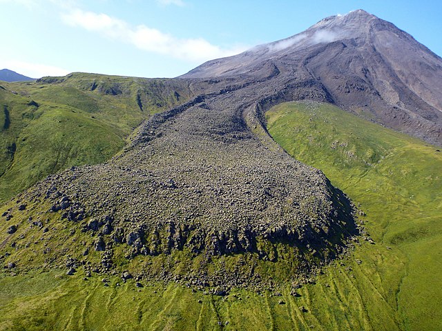
A photo from Kanaga Volcano, one of the most southerly members of the Aleutian Islands chain. In the foreground is a stunning view of a lava flow from a 1906 event. According to records, a trapper living on the island in 1906 experienced several earthquakes and witnessed lava pouring down both east and west sides of the cone. You can learn more about Kanaga Volcano, see images, and read about current past activity at on.doi.gov/Kanaga . Photo credit: Michelle Combs, USGS. |
| Date | |
| Source | Kanaga Volcano |
| Author | Michelle Combs, USGS |
| Camera location |
|
View this and other nearby images on: OpenStreetMap |
|
|---|
.jpg¶ms=051.926586_N_-177.117156_E_globe:Earth_type:camera_source:Flickr_&language=en)
Licensing
|
|
This image is in the
public domain
in the United States because it only contains materials that originally came from the
United States Geological Survey
, an agency of the
United States Department of the Interior
. For more information, see
the official USGS copyright policy
.
|
|